You are here: Home > Network List > TA - USArray Transportable Network (new EarthScope stations) Stations List
> Station E20K Nigu River, AK, USA > Earthquake Result Viewer
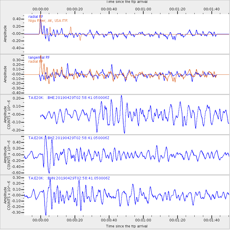
E20K Nigu River, AK, USA - Earthquake Result Viewer
*The percent match for this event was below the threshold and hence no stack was calculated.
| Earthquake location: |
Northern Mid-Atlantic Ridge |
| Earthquake latitude/longitude: |
43.2/-29.1 |
| Earthquake time(UTC): |
2019/04/29 (119) 02:48:51 GMT |
| Earthquake Depth: |
10 km |
| Earthquake Magnitude: |
5.5 Mww |
| Earthquake Catalog/Contributor: |
NEIC PDE/us |
|
| Network: |
TA USArray Transportable Network (new EarthScope stations) |
| Station: |
E20K Nigu River, AK, USA |
| Lat/Lon: |
68.26 N/156.19 W |
| Elevation: |
866 m |
|
| Distance: |
62.1 deg |
| Az: |
340.335 deg |
| Baz: |
41.353 deg |
| Ray Param: |
$rayparam |
*The percent match for this event was below the threshold and hence was not used in the summary stack. |
|
| Radial Match: |
62.361412 % |
| Radial Bump: |
400 |
| Transverse Match: |
62.030827 % |
| Transverse Bump: |
390 |
| SOD ConfigId: |
18252611 |
| Insert Time: |
2019-05-13 02:56:51.443 +0000 |
| GWidth: |
2.5 |
| Max Bumps: |
400 |
| Tol: |
0.001 |
|
Signal To Noise
| Channel | StoN | STA | LTA |
| TA:E20K: :BHZ:20190429T02:58:41.050006Z | 3.7907476 | 3.1347906E-7 | 8.269584E-8 |
| TA:E20K: :BHN:20190429T02:58:41.050006Z | 2.2761488 | 1.4030837E-7 | 6.1642886E-8 |
| TA:E20K: :BHE:20190429T02:58:41.050006Z | 2.0254526 | 9.001308E-8 | 4.444097E-8 |
| Arrivals |
| Ps | |
| PpPs | |
| PsPs/PpSs | |


