You are here: Home > Network List > TA - USArray Transportable Network (new EarthScope stations) Stations List
> Station L16A Fish Haven, ID, USA > Earthquake Result Viewer
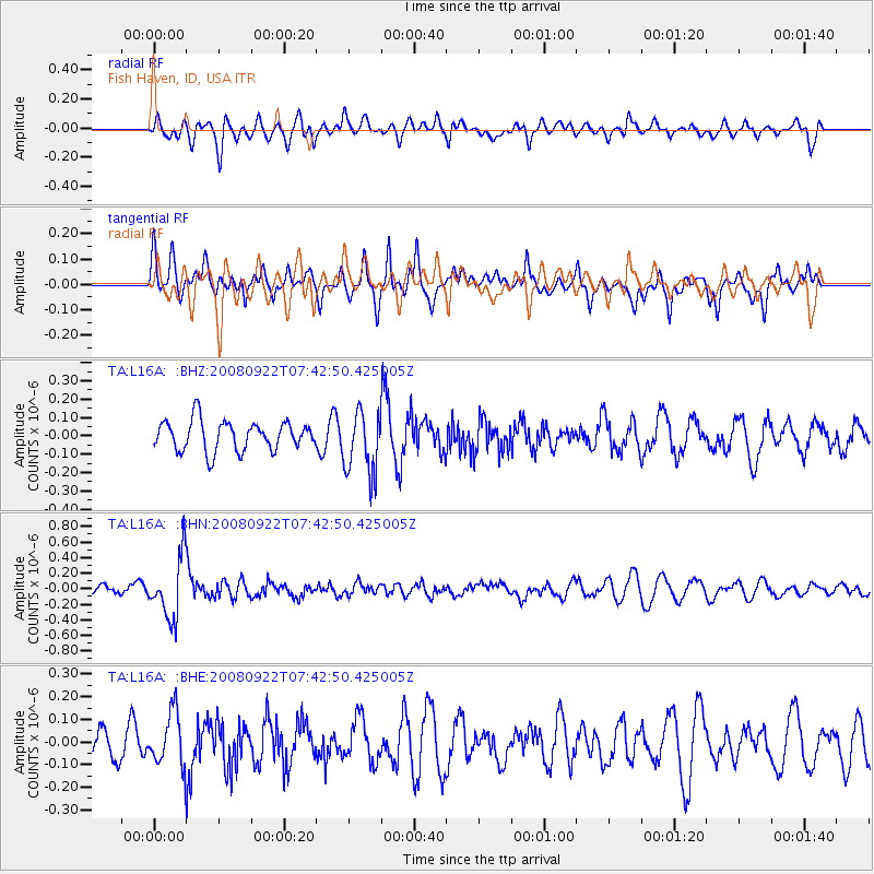
L16A Fish Haven, ID, USA - Earthquake Result Viewer
*The percent match for this event was below the threshold and hence no stack was calculated.
| Earthquake location: |
Hokkaido, Japan Region |
| Earthquake latitude/longitude: |
41.6/140.4 |
| Earthquake time(UTC): |
2008/09/22 (266) 07:31:59 GMT |
| Earthquake Depth: |
149 km |
| Earthquake Magnitude: |
5.7 MW, 5.3 MB, 5.6 MW |
| Earthquake Catalog/Contributor: |
WHDF/NEIC |
|
| Network: |
TA USArray Transportable Network (new EarthScope stations) |
| Station: |
L16A Fish Haven, ID, USA |
| Lat/Lon: |
42.01 N/111.43 W |
| Elevation: |
2013 m |
|
| Distance: |
74.5 deg |
| Az: |
47.302 deg |
| Baz: |
312.275 deg |
| Ray Param: |
$rayparam |
*The percent match for this event was below the threshold and hence was not used in the summary stack. |
|
| Radial Match: |
37.162712 % |
| Radial Bump: |
361 |
| Transverse Match: |
64.8589 % |
| Transverse Bump: |
374 |
| SOD ConfigId: |
2560 |
| Insert Time: |
2010-03-06 21:51:58.419 +0000 |
| GWidth: |
2.5 |
| Max Bumps: |
400 |
| Tol: |
0.001 |
|
Signal To Noise
| Channel | StoN | STA | LTA |
| TA:L16A: :BHN:20080922T07:42:50.425005Z | 5.434196 | 3.8967346E-7 | 7.170765E-8 |
| TA:L16A: :BHE:20080922T07:42:50.425005Z | 2.244526 | 1.152888E-7 | 5.136443E-8 |
| TA:L16A: :BHZ:20080922T07:42:50.425005Z | 2.1489427 | 1.7333707E-7 | 8.0661565E-8 |
| Arrivals |
| Ps | |
| PpPs | |
| PsPs/PpSs | |


