You are here: Home > Network List > TA - USArray Transportable Network (new EarthScope stations) Stations List
> Station F26K Sheenjek River, AK, USA > Earthquake Result Viewer
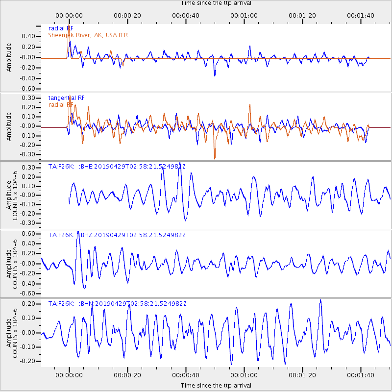
F26K Sheenjek River, AK, USA - Earthquake Result Viewer
*The percent match for this event was below the threshold and hence no stack was calculated.
| Earthquake location: |
Northern Mid-Atlantic Ridge |
| Earthquake latitude/longitude: |
43.2/-29.1 |
| Earthquake time(UTC): |
2019/04/29 (119) 02:48:51 GMT |
| Earthquake Depth: |
10 km |
| Earthquake Magnitude: |
5.5 Mww |
| Earthquake Catalog/Contributor: |
NEIC PDE/us |
|
| Network: |
TA USArray Transportable Network (new EarthScope stations) |
| Station: |
F26K Sheenjek River, AK, USA |
| Lat/Lon: |
67.69 N/144.15 W |
| Elevation: |
683 m |
|
| Distance: |
59.2 deg |
| Az: |
336.252 deg |
| Baz: |
50.508 deg |
| Ray Param: |
$rayparam |
*The percent match for this event was below the threshold and hence was not used in the summary stack. |
|
| Radial Match: |
55.1239 % |
| Radial Bump: |
394 |
| Transverse Match: |
59.455345 % |
| Transverse Bump: |
400 |
| SOD ConfigId: |
18252611 |
| Insert Time: |
2019-05-13 02:57:00.558 +0000 |
| GWidth: |
2.5 |
| Max Bumps: |
400 |
| Tol: |
0.001 |
|
Signal To Noise
| Channel | StoN | STA | LTA |
| TA:F26K: :BHZ:20190429T02:58:21.524982Z | 3.795246 | 3.1688194E-7 | 8.349444E-8 |
| TA:F26K: :BHN:20190429T02:58:21.524982Z | 1.3132136 | 9.11349E-8 | 6.939839E-8 |
| TA:F26K: :BHE:20190429T02:58:21.524982Z | 2.6883962 | 1.6103233E-7 | 5.989903E-8 |
| Arrivals |
| Ps | |
| PpPs | |
| PsPs/PpSs | |


