You are here: Home > Network List > TA - USArray Transportable Network (new EarthScope stations) Stations List
> Station H31M Peel River, Yukon, CAN > Earthquake Result Viewer
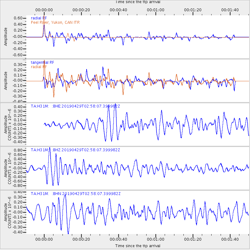
H31M Peel River, Yukon, CAN - Earthquake Result Viewer
*The percent match for this event was below the threshold and hence no stack was calculated.
| Earthquake location: |
Northern Mid-Atlantic Ridge |
| Earthquake latitude/longitude: |
43.2/-29.1 |
| Earthquake time(UTC): |
2019/04/29 (119) 02:48:51 GMT |
| Earthquake Depth: |
10 km |
| Earthquake Magnitude: |
5.5 Mww |
| Earthquake Catalog/Contributor: |
NEIC PDE/us |
|
| Network: |
TA USArray Transportable Network (new EarthScope stations) |
| Station: |
H31M Peel River, Yukon, CAN |
| Lat/Lon: |
65.81 N/134.34 W |
| Elevation: |
642 m |
|
| Distance: |
57.2 deg |
| Az: |
331.755 deg |
| Baz: |
57.138 deg |
| Ray Param: |
$rayparam |
*The percent match for this event was below the threshold and hence was not used in the summary stack. |
|
| Radial Match: |
76.15264 % |
| Radial Bump: |
400 |
| Transverse Match: |
54.19561 % |
| Transverse Bump: |
382 |
| SOD ConfigId: |
18252611 |
| Insert Time: |
2019-05-13 02:57:13.627 +0000 |
| GWidth: |
2.5 |
| Max Bumps: |
400 |
| Tol: |
0.001 |
|
Signal To Noise
| Channel | StoN | STA | LTA |
| TA:H31M: :BHZ:20190429T02:58:07.399982Z | 7.1328464 | 4.6847464E-7 | 6.56785E-8 |
| TA:H31M: :BHN:20190429T02:58:07.399982Z | 1.1576686 | 1.2618737E-7 | 1.090013E-7 |
| TA:H31M: :BHE:20190429T02:58:07.399982Z | 3.9938953 | 2.1783087E-7 | 5.454096E-8 |
| Arrivals |
| Ps | |
| PpPs | |
| PsPs/PpSs | |


