You are here: Home > Network List > TA - USArray Transportable Network (new EarthScope stations) Stations List
> Station J20K Nowitna River, AK, USA > Earthquake Result Viewer
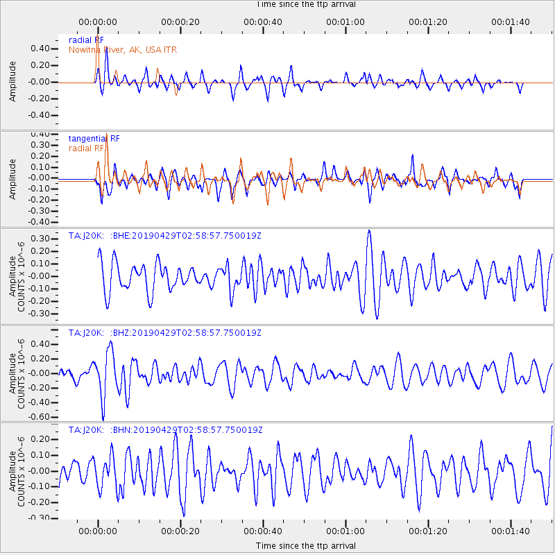
J20K Nowitna River, AK, USA - Earthquake Result Viewer
*The percent match for this event was below the threshold and hence no stack was calculated.
| Earthquake location: |
Northern Mid-Atlantic Ridge |
| Earthquake latitude/longitude: |
43.2/-29.1 |
| Earthquake time(UTC): |
2019/04/29 (119) 02:48:51 GMT |
| Earthquake Depth: |
10 km |
| Earthquake Magnitude: |
5.5 Mww |
| Earthquake Catalog/Contributor: |
NEIC PDE/us |
|
| Network: |
TA USArray Transportable Network (new EarthScope stations) |
| Station: |
J20K Nowitna River, AK, USA |
| Lat/Lon: |
64.18 N/154.15 W |
| Elevation: |
314 m |
|
| Distance: |
64.6 deg |
| Az: |
336.605 deg |
| Baz: |
41.545 deg |
| Ray Param: |
$rayparam |
*The percent match for this event was below the threshold and hence was not used in the summary stack. |
|
| Radial Match: |
55.791534 % |
| Radial Bump: |
400 |
| Transverse Match: |
46.4384 % |
| Transverse Bump: |
394 |
| SOD ConfigId: |
18252611 |
| Insert Time: |
2019-05-13 02:57:18.775 +0000 |
| GWidth: |
2.5 |
| Max Bumps: |
400 |
| Tol: |
0.001 |
|
Signal To Noise
| Channel | StoN | STA | LTA |
| TA:J20K: :BHZ:20190429T02:58:57.750019Z | 5.464492 | 3.076404E-7 | 5.6298077E-8 |
| TA:J20K: :BHN:20190429T02:58:57.750019Z | 0.9757322 | 9.954802E-8 | 1.0202391E-7 |
| TA:J20K: :BHE:20190429T02:58:57.750019Z | 0.9039552 | 9.930249E-8 | 1.0985333E-7 |
| Arrivals |
| Ps | |
| PpPs | |
| PsPs/PpSs | |


