You are here: Home > Network List > TS - TERRAscope (Southern California Seismic Network) Stations List
> Station DGR Domenigoni Valley Reservior, California, USA > Earthquake Result Viewer
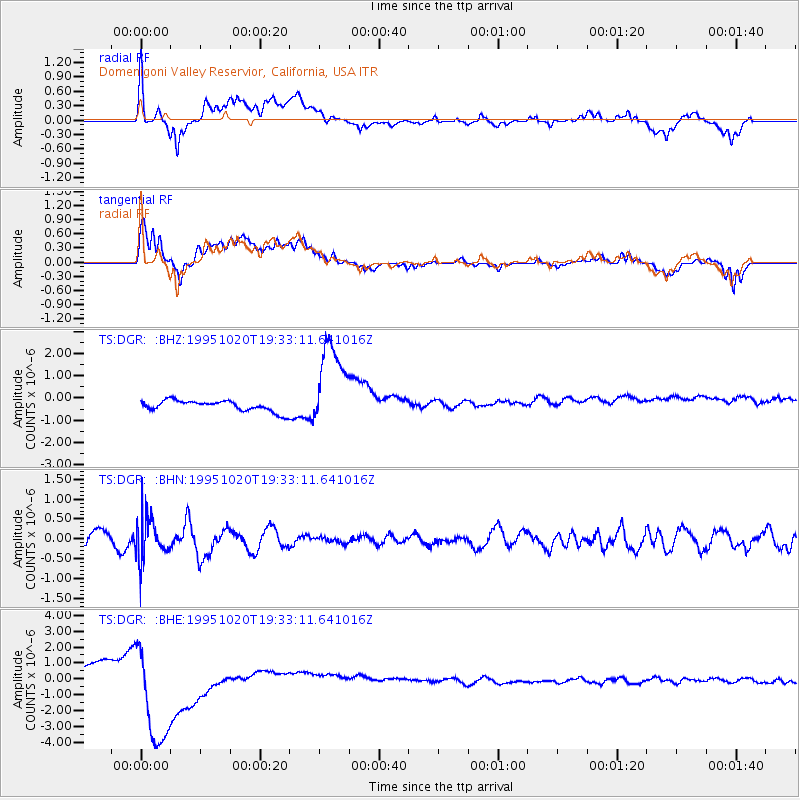
DGR Domenigoni Valley Reservior, California, USA - Earthquake Result Viewer
*The percent match for this event was below the threshold and hence no stack was calculated.
| Earthquake location: |
Mariana Islands |
| Earthquake latitude/longitude: |
18.8/145.4 |
| Earthquake time(UTC): |
1995/10/20 (293) 19:21:28 GMT |
| Earthquake Depth: |
225 km |
| Earthquake Magnitude: |
5.5 UNKNOWN, 5.3 MB |
| Earthquake Catalog/Contributor: |
WHDF/NEIC |
|
| Network: |
TS TERRAscope (Southern California Seismic Network) |
| Station: |
DGR Domenigoni Valley Reservior, California, USA |
| Lat/Lon: |
33.65 N/117.01 W |
| Elevation: |
700 m |
|
| Distance: |
85.9 deg |
| Az: |
55.993 deg |
| Baz: |
289.685 deg |
| Ray Param: |
$rayparam |
*The percent match for this event was below the threshold and hence was not used in the summary stack. |
|
| Radial Match: |
14.115228 % |
| Radial Bump: |
400 |
| Transverse Match: |
18.650642 % |
| Transverse Bump: |
400 |
| SOD ConfigId: |
4480 |
| Insert Time: |
2010-02-26 14:11:24.872 +0000 |
| GWidth: |
2.5 |
| Max Bumps: |
400 |
| Tol: |
0.001 |
|
Signal To Noise
| Channel | StoN | STA | LTA |
| TS:DGR: :BHN:19951020T19:33:11.641016Z | 2.4667094 | 5.321358E-7 | 2.15727E-7 |
| TS:DGR: :BHE:19951020T19:33:11.641016Z | 8.950334 | 3.4043157E-6 | 3.8035628E-7 |
| TS:DGR: :BHZ:19951020T19:33:11.641016Z | 8.3121395 | 2.0064656E-6 | 2.4138978E-7 |
| Arrivals |
| Ps | |
| PpPs | |
| PsPs/PpSs | |


