You are here: Home > Network List > AV - Alaska Volcano Observatory Stations List
> Station SPCR Ckakachatna River, Mount Spurr, Alaska > Earthquake Result Viewer
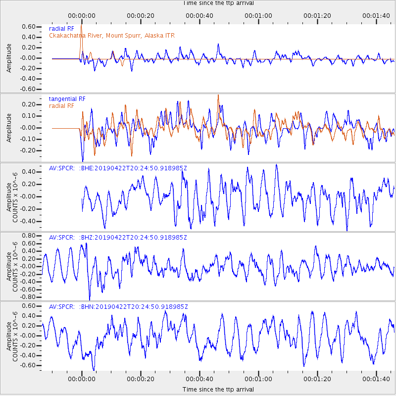
SPCR Ckakachatna River, Mount Spurr, Alaska - Earthquake Result Viewer
*The percent match for this event was below the threshold and hence no stack was calculated.
| Earthquake location: |
Near Coast Of Guerrero, Mexico |
| Earthquake latitude/longitude: |
16.4/-98.5 |
| Earthquake time(UTC): |
2019/04/22 (112) 20:15:24 GMT |
| Earthquake Depth: |
12 km |
| Earthquake Magnitude: |
5.4 Mww |
| Earthquake Catalog/Contributor: |
NEIC PDE/us |
|
| Network: |
AV Alaska Volcano Observatory |
| Station: |
SPCR Ckakachatna River, Mount Spurr, Alaska |
| Lat/Lon: |
61.20 N/152.21 W |
| Elevation: |
984 m |
|
| Distance: |
58.7 deg |
| Az: |
332.805 deg |
| Baz: |
115.033 deg |
| Ray Param: |
$rayparam |
*The percent match for this event was below the threshold and hence was not used in the summary stack. |
|
| Radial Match: |
63.707355 % |
| Radial Bump: |
400 |
| Transverse Match: |
59.660427 % |
| Transverse Bump: |
400 |
| SOD ConfigId: |
18252611 |
| Insert Time: |
2019-05-16 13:56:57.695 +0000 |
| GWidth: |
2.5 |
| Max Bumps: |
400 |
| Tol: |
0.001 |
|
Signal To Noise
| Channel | StoN | STA | LTA |
| AV:SPCR: :BHZ:20190422T20:24:50.918985Z | 2.0294545 | 4.32531E-7 | 2.1312673E-7 |
| AV:SPCR: :BHN:20190422T20:24:50.918985Z | 3.7949755 | 4.988011E-7 | 1.3143723E-7 |
| AV:SPCR: :BHE:20190422T20:24:50.918985Z | 1.3362516 | 2.4173502E-7 | 1.809053E-7 |
| Arrivals |
| Ps | |
| PpPs | |
| PsPs/PpSs | |


