You are here: Home > Network List > TA - USArray Transportable Network (new EarthScope stations) Stations List
> Station E20K Nigu River, AK, USA > Earthquake Result Viewer
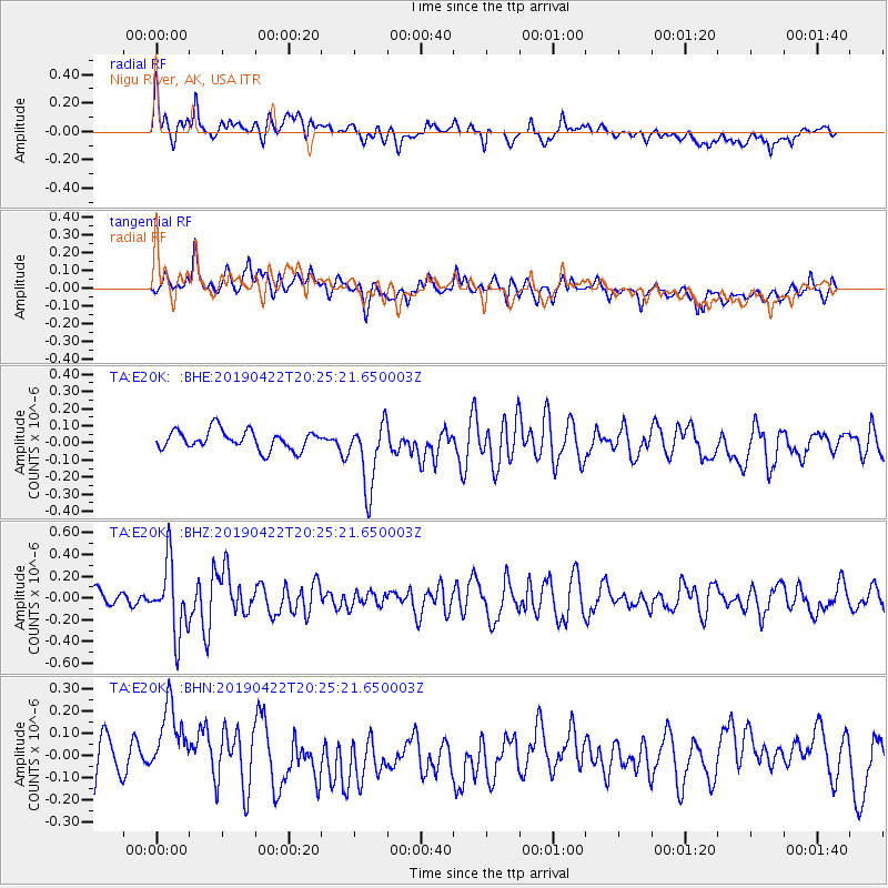
E20K Nigu River, AK, USA - Earthquake Result Viewer
*The percent match for this event was below the threshold and hence no stack was calculated.
| Earthquake location: |
Near Coast Of Guerrero, Mexico |
| Earthquake latitude/longitude: |
16.4/-98.5 |
| Earthquake time(UTC): |
2019/04/22 (112) 20:15:24 GMT |
| Earthquake Depth: |
12 km |
| Earthquake Magnitude: |
5.4 Mww |
| Earthquake Catalog/Contributor: |
NEIC PDE/us |
|
| Network: |
TA USArray Transportable Network (new EarthScope stations) |
| Station: |
E20K Nigu River, AK, USA |
| Lat/Lon: |
68.26 N/156.19 W |
| Elevation: |
866 m |
|
| Distance: |
63.2 deg |
| Az: |
339.339 deg |
| Baz: |
114.611 deg |
| Ray Param: |
$rayparam |
*The percent match for this event was below the threshold and hence was not used in the summary stack. |
|
| Radial Match: |
51.99045 % |
| Radial Bump: |
400 |
| Transverse Match: |
68.914536 % |
| Transverse Bump: |
400 |
| SOD ConfigId: |
18252611 |
| Insert Time: |
2019-05-16 14:00:29.110 +0000 |
| GWidth: |
2.5 |
| Max Bumps: |
400 |
| Tol: |
0.001 |
|
Signal To Noise
| Channel | StoN | STA | LTA |
| TA:E20K: :BHZ:20190422T20:25:21.650003Z | 2.7496529 | 3.2221897E-7 | 1.1718533E-7 |
| TA:E20K: :BHN:20190422T20:25:21.650003Z | 1.718154 | 1.8266469E-7 | 1.0631451E-7 |
| TA:E20K: :BHE:20190422T20:25:21.650003Z | 3.4897723 | 1.9612177E-7 | 5.6199017E-8 |
| Arrivals |
| Ps | |
| PpPs | |
| PsPs/PpSs | |


