You are here: Home > Network List > TA - USArray Transportable Network (new EarthScope stations) Stations List
> Station L15K Ungalak Mountain, AK, USA > Earthquake Result Viewer
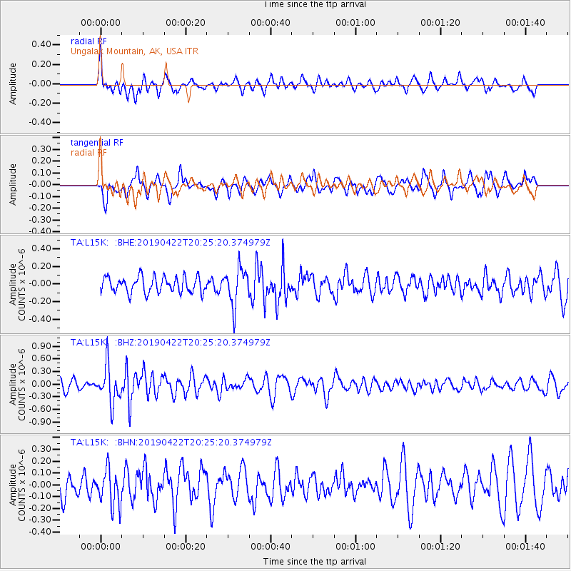
L15K Ungalak Mountain, AK, USA - Earthquake Result Viewer
*The percent match for this event was below the threshold and hence no stack was calculated.
| Earthquake location: |
Near Coast Of Guerrero, Mexico |
| Earthquake latitude/longitude: |
16.4/-98.5 |
| Earthquake time(UTC): |
2019/04/22 (112) 20:15:24 GMT |
| Earthquake Depth: |
12 km |
| Earthquake Magnitude: |
5.4 Mww |
| Earthquake Catalog/Contributor: |
NEIC PDE/us |
|
| Network: |
TA USArray Transportable Network (new EarthScope stations) |
| Station: |
L15K Ungalak Mountain, AK, USA |
| Lat/Lon: |
61.68 N/161.49 W |
| Elevation: |
219 m |
|
| Distance: |
63.0 deg |
| Az: |
331.519 deg |
| Baz: |
106.265 deg |
| Ray Param: |
$rayparam |
*The percent match for this event was below the threshold and hence was not used in the summary stack. |
|
| Radial Match: |
55.1058 % |
| Radial Bump: |
400 |
| Transverse Match: |
52.261 % |
| Transverse Bump: |
390 |
| SOD ConfigId: |
18252611 |
| Insert Time: |
2019-05-16 14:01:03.184 +0000 |
| GWidth: |
2.5 |
| Max Bumps: |
400 |
| Tol: |
0.001 |
|
Signal To Noise
| Channel | StoN | STA | LTA |
| TA:L15K: :BHZ:20190422T20:25:20.374979Z | 3.8051882 | 4.5126998E-7 | 1.1859335E-7 |
| TA:L15K: :BHN:20190422T20:25:20.374979Z | 1.3415077 | 1.5802664E-7 | 1.17797796E-7 |
| TA:L15K: :BHE:20190422T20:25:20.374979Z | 2.3582525 | 2.1099308E-7 | 8.947009E-8 |
| Arrivals |
| Ps | |
| PpPs | |
| PsPs/PpSs | |


