You are here: Home > Network List > US - United States National Seismic Network Stations List
> Station DGMT Dagmar, Montana, USA > Earthquake Result Viewer
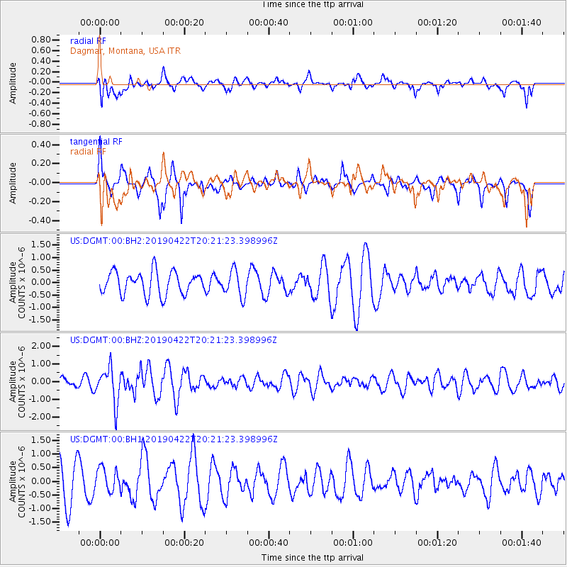
DGMT Dagmar, Montana, USA - Earthquake Result Viewer
*The percent match for this event was below the threshold and hence no stack was calculated.
| Earthquake location: |
Near Coast Of Guerrero, Mexico |
| Earthquake latitude/longitude: |
16.4/-98.5 |
| Earthquake time(UTC): |
2019/04/22 (112) 20:15:24 GMT |
| Earthquake Depth: |
12 km |
| Earthquake Magnitude: |
5.4 Mww |
| Earthquake Catalog/Contributor: |
NEIC PDE/us |
|
| Network: |
US United States National Seismic Network |
| Station: |
DGMT Dagmar, Montana, USA |
| Lat/Lon: |
48.47 N/104.20 W |
| Elevation: |
0.0 m |
|
| Distance: |
32.4 deg |
| Az: |
352.895 deg |
| Baz: |
169.722 deg |
| Ray Param: |
$rayparam |
*The percent match for this event was below the threshold and hence was not used in the summary stack. |
|
| Radial Match: |
44.458065 % |
| Radial Bump: |
400 |
| Transverse Match: |
62.25485 % |
| Transverse Bump: |
323 |
| SOD ConfigId: |
18252611 |
| Insert Time: |
2019-05-16 14:01:44.762 +0000 |
| GWidth: |
2.5 |
| Max Bumps: |
400 |
| Tol: |
0.001 |
|
Signal To Noise
| Channel | StoN | STA | LTA |
| US:DGMT:00:BHZ:20190422T20:21:23.398996Z | 3.5860472 | 1.0121197E-6 | 2.8223826E-7 |
| US:DGMT:00:BH1:20190422T20:21:23.398996Z | 0.7158111 | 4.5457045E-7 | 6.350425E-7 |
| US:DGMT:00:BH2:20190422T20:21:23.398996Z | 1.1715034 | 5.3599456E-7 | 4.5752705E-7 |
| Arrivals |
| Ps | |
| PpPs | |
| PsPs/PpSs | |


