You are here: Home > Network List > UW - Pacific Northwest Regional Seismic Network Stations List
> Station UMAT Pilot Rock, OR, USA > Earthquake Result Viewer
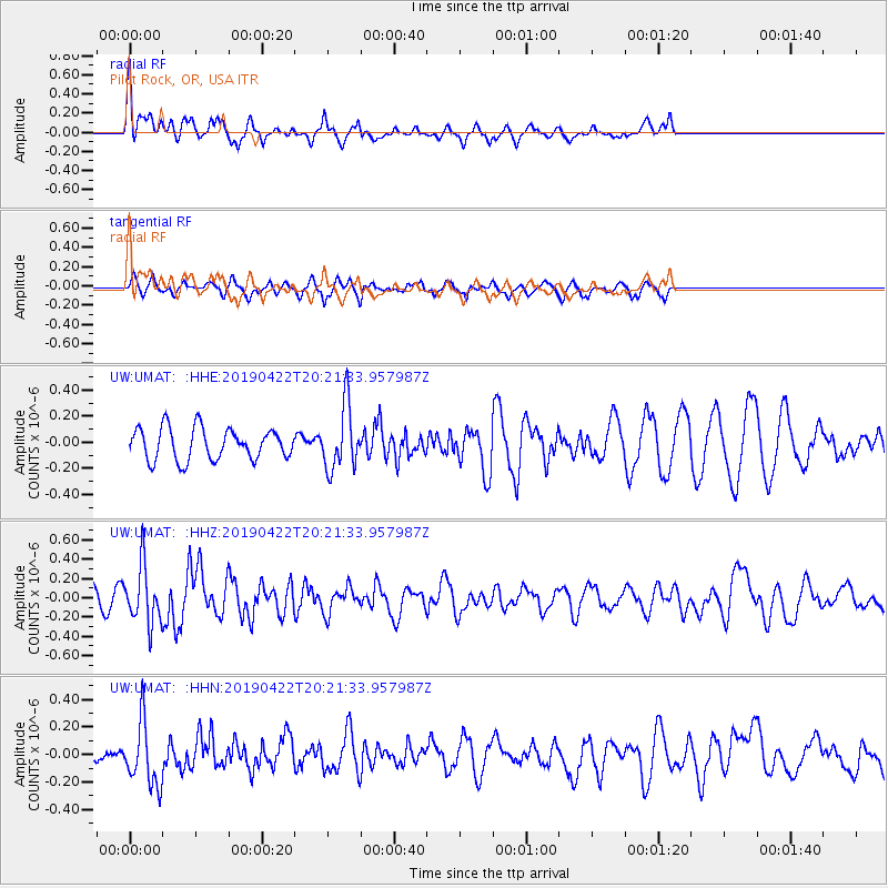
UMAT Pilot Rock, OR, USA - Earthquake Result Viewer
*The percent match for this event was below the threshold and hence no stack was calculated.
| Earthquake location: |
Near Coast Of Guerrero, Mexico |
| Earthquake latitude/longitude: |
16.4/-98.5 |
| Earthquake time(UTC): |
2019/04/22 (112) 20:15:24 GMT |
| Earthquake Depth: |
12 km |
| Earthquake Magnitude: |
5.4 Mww |
| Earthquake Catalog/Contributor: |
NEIC PDE/us |
|
| Network: |
UW Pacific Northwest Regional Seismic Network |
| Station: |
UMAT Pilot Rock, OR, USA |
| Lat/Lon: |
45.29 N/118.96 W |
| Elevation: |
1318 m |
|
| Distance: |
33.6 deg |
| Az: |
333.484 deg |
| Baz: |
142.615 deg |
| Ray Param: |
$rayparam |
*The percent match for this event was below the threshold and hence was not used in the summary stack. |
|
| Radial Match: |
64.19623 % |
| Radial Bump: |
400 |
| Transverse Match: |
37.18828 % |
| Transverse Bump: |
309 |
| SOD ConfigId: |
18252611 |
| Insert Time: |
2019-05-16 14:02:06.067 +0000 |
| GWidth: |
2.5 |
| Max Bumps: |
400 |
| Tol: |
0.001 |
|
Signal To Noise
| Channel | StoN | STA | LTA |
| UW:UMAT: :HHZ:20190422T20:21:33.957987Z | 2.7042289 | 2.9429114E-7 | 1.08826264E-7 |
| UW:UMAT: :HHN:20190422T20:21:33.957987Z | 3.896966 | 2.3366347E-7 | 5.996036E-8 |
| UW:UMAT: :HHE:20190422T20:21:33.957987Z | 2.0386288 | 2.4462162E-7 | 1.199932E-7 |
| Arrivals |
| Ps | |
| PpPs | |
| PsPs/PpSs | |


