You are here: Home > Network List > TS - TERRAscope (Southern California Seismic Network) Stations List
> Station DGR Domenigoni Valley Reservior, California, USA > Earthquake Result Viewer
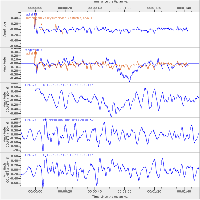
DGR Domenigoni Valley Reservior, California, USA - Earthquake Result Viewer
*The percent match for this event was below the threshold and hence no stack was calculated.
| Earthquake location: |
Southern East Pacific Rise |
| Earthquake latitude/longitude: |
-21.5/-113.7 |
| Earthquake time(UTC): |
1994/03/06 (065) 08:01:43 GMT |
| Earthquake Depth: |
10 km |
| Earthquake Magnitude: |
5.5 MB, 5.6 MS, 5.8 UNKNOWN |
| Earthquake Catalog/Contributor: |
WHDF/NEIC |
|
| Network: |
TS TERRAscope (Southern California Seismic Network) |
| Station: |
DGR Domenigoni Valley Reservior, California, USA |
| Lat/Lon: |
33.65 N/117.01 W |
| Elevation: |
700 m |
|
| Distance: |
54.9 deg |
| Az: |
356.58 deg |
| Baz: |
176.181 deg |
| Ray Param: |
$rayparam |
*The percent match for this event was below the threshold and hence was not used in the summary stack. |
|
| Radial Match: |
58.312637 % |
| Radial Bump: |
400 |
| Transverse Match: |
45.052834 % |
| Transverse Bump: |
400 |
| SOD ConfigId: |
4480 |
| Insert Time: |
2010-02-26 14:11:28.054 +0000 |
| GWidth: |
2.5 |
| Max Bumps: |
400 |
| Tol: |
0.001 |
|
Signal To Noise
| Channel | StoN | STA | LTA |
| TS:DGR: :BHN:19940306T08:10:43.203015Z | 1.0819446 | 3.55107E-7 | 3.2821183E-7 |
| TS:DGR: :BHE:19940306T08:10:43.203015Z | 2.3354652 | 2.2997669E-7 | 9.847147E-8 |
| TS:DGR: :BHZ:19940306T08:10:43.203015Z | 0.32078233 | 8.4355776E-8 | 2.629689E-7 |
| Arrivals |
| Ps | |
| PpPs | |
| PsPs/PpSs | |


