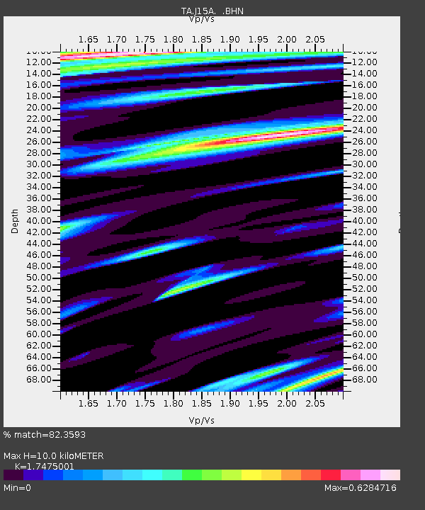
J15A Blackfoot, ID, USA - Earthquake Result Viewer
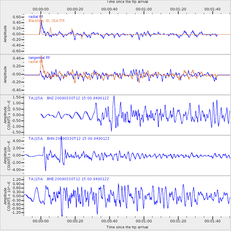
Earthquake location: Andreanof Islands, Aleutian Is.
Earthquake latitude/longitude: 51.5/-178.3
Earthquake time(UTC): 2009/03/30 (089) 12:07:28 GMT
Earthquake Depth: 31 km
Earthquake Magnitude: 6.0 MB, 5.5 MS, 5.7 MW, 5.7 MW
Earthquake Catalog/Contributor: WHDF/NEIC
Network: TA USArray Transportable Network (new EarthScope stations)
Station: J15A Blackfoot, ID, USA
Lat/Lon: 43.40 N/112.43 W
Elevation: 1497 m
Distance: 43.9 deg
Az: 73.694 deg
Baz: 304.668 deg
Ray Param: 0.07221978
Estimated Moho Depth: 10.0 km
Estimated Crust Vp/Vs: 1.75
Assumed Crust Vp: 6.279 km/s
Estimated Crust Vs: 3.593 km/s
Estimated Crust Poisson's Ratio: 0.26
Radial Match: 82.3593 %
Radial Bump: 400
Transverse Match: 76.92575 %
Transverse Bump: 400
SOD ConfigId: 2658
Insert Time: 2010-03-06 21:55:46.418 +0000
GWidth: 2.5
Max Bumps: 400
Tol: 0.001

Signal To Noise

ChannelStoNSTALTA
TA:J15A: :BHN:20090330T12:15:00.949012Z6.19705151.4031231E-62.2641784E-7
TA:J15A: :BHE:20090330T12:15:00.949012Z4.1588414.6296265E-71.11320105E-7
TA:J15A: :BHZ:20090330T12:15:00.949012Z3.21464874.7479688E-71.476979E-7
Arrivals
Ps1.3 SECOND
PpPs4.1 SECOND
PsPs/PpSs5.4 SECOND