You are here: Home > Network List > US - United States National Seismic Network Stations List
> Station DGMT Dagmar, Montana, USA > Earthquake Result Viewer
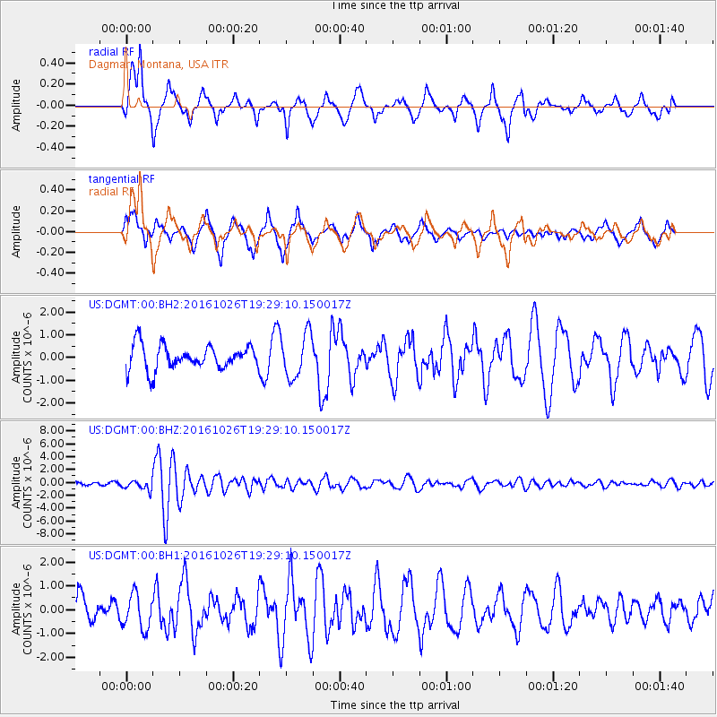
DGMT Dagmar, Montana, USA - Earthquake Result Viewer
*The percent match for this event was below the threshold and hence no stack was calculated.
| Earthquake location: |
Central Italy |
| Earthquake latitude/longitude: |
42.9/13.0 |
| Earthquake time(UTC): |
2016/10/26 (300) 19:18:08 GMT |
| Earthquake Depth: |
10 km |
| Earthquake Magnitude: |
6.1 MWW, 6.0 MWB, 6.1 MWR |
| Earthquake Catalog/Contributor: |
NEIC PDE/NEIC COMCAT |
|
| Network: |
US United States National Seismic Network |
| Station: |
DGMT Dagmar, Montana, USA |
| Lat/Lon: |
48.47 N/104.20 W |
| Elevation: |
0.0 m |
|
| Distance: |
73.6 deg |
| Az: |
321.91 deg |
| Baz: |
42.904 deg |
| Ray Param: |
$rayparam |
*The percent match for this event was below the threshold and hence was not used in the summary stack. |
|
| Radial Match: |
70.52731 % |
| Radial Bump: |
400 |
| Transverse Match: |
68.61343 % |
| Transverse Bump: |
400 |
| SOD ConfigId: |
1815711 |
| Insert Time: |
2016-11-09 19:24:50.876 +0000 |
| GWidth: |
2.5 |
| Max Bumps: |
400 |
| Tol: |
0.001 |
|
Signal To Noise
| Channel | StoN | STA | LTA |
| US:DGMT:00:BHZ:20161026T19:29:10.150017Z | 2.7483175 | 7.4459706E-7 | 2.7092833E-7 |
| US:DGMT:00:BH1:20161026T19:29:10.150017Z | 0.84729433 | 7.293063E-7 | 8.6074726E-7 |
| US:DGMT:00:BH2:20161026T19:29:10.150017Z | 1.8265101 | 9.678497E-7 | 5.2989014E-7 |
| Arrivals |
| Ps | |
| PpPs | |
| PsPs/PpSs | |


