J15A Blackfoot, ID, USA - Earthquake Result Viewer
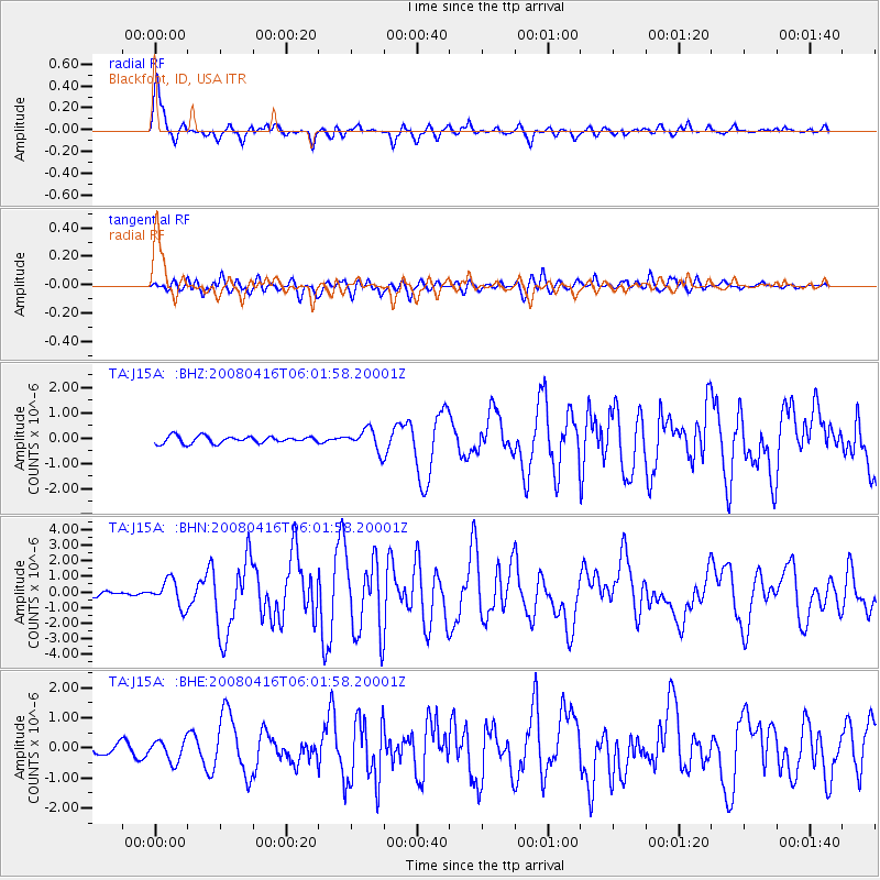
Earthquake location: Andreanof Islands, Aleutian Is.
Earthquake latitude/longitude: 51.9/-179.2
Earthquake time(UTC): 2008/04/16 (107) 05:54:19 GMT
Earthquake Depth: 13 km
Earthquake Magnitude: 6.1 MB, 6.5 MS, 6.6 MW, 6.6 MW
Earthquake Catalog/Contributor: WHDF/NEIC
Network: TA USArray Transportable Network (new EarthScope stations)
Station: J15A Blackfoot, ID, USA
Lat/Lon: 43.40 N/112.43 W
Elevation: 1497 m
Distance: 44.3 deg
Az: 73.489 deg
Baz: 305.371 deg
Ray Param: 0.0719951
Estimated Moho Depth: 46.0 km
Estimated Crust Vp/Vs: 1.72
Assumed Crust Vp: 6.279 km/s
Estimated Crust Vs: 3.656 km/s
Estimated Crust Poisson's Ratio: 0.24
Radial Match: 94.948685 %
Radial Bump: 400
Transverse Match: 77.21866 %
Transverse Bump: 400
SOD ConfigId: 2504
Insert Time: 2010-03-06 21:56:30.820 +0000
GWidth: 2.5
Max Bumps: 400
Tol: 0.001

Signal To Noise

ChannelStoNSTALTA
TA:J15A: :BHN:20080416T06:01:58.20001Z6.42991458.418631E-71.3092912E-7
TA:J15A: :BHE:20080416T06:01:58.20001Z2.52272843.5439518E-71.404809E-7
TA:J15A: :BHZ:20080416T06:01:58.20001Z3.0338244.219215E-71.390725E-7
Arrivals
Ps5.6 SECOND
PpPs19 SECOND
PsPs/PpSs24 SECOND