You are here: Home > Network List > IW - Intermountain West Stations List
> Station MOOW Moose Ponds, Wyoming, USA > Earthquake Result Viewer
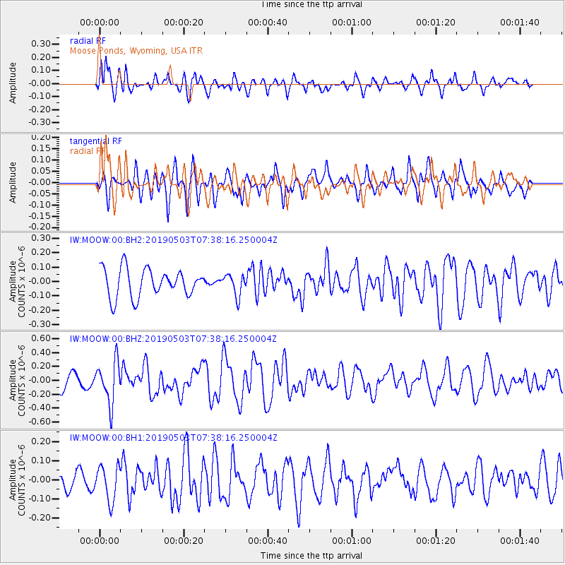
MOOW Moose Ponds, Wyoming, USA - Earthquake Result Viewer
*The percent match for this event was below the threshold and hence no stack was calculated.
| Earthquake location: |
Solomon Islands |
| Earthquake latitude/longitude: |
-6.9/160.1 |
| Earthquake time(UTC): |
2019/05/03 (123) 07:25:29 GMT |
| Earthquake Depth: |
10 km |
| Earthquake Magnitude: |
6.1 Mww |
| Earthquake Catalog/Contributor: |
NEIC PDE/us |
|
| Network: |
IW Intermountain West |
| Station: |
MOOW Moose Ponds, Wyoming, USA |
| Lat/Lon: |
43.75 N/110.74 W |
| Elevation: |
2128 m |
|
| Distance: |
94.1 deg |
| Az: |
46.593 deg |
| Baz: |
264.408 deg |
| Ray Param: |
$rayparam |
*The percent match for this event was below the threshold and hence was not used in the summary stack. |
|
| Radial Match: |
59.76543 % |
| Radial Bump: |
400 |
| Transverse Match: |
63.914036 % |
| Transverse Bump: |
400 |
| SOD ConfigId: |
18252611 |
| Insert Time: |
2019-05-17 07:29:41.108 +0000 |
| GWidth: |
2.5 |
| Max Bumps: |
400 |
| Tol: |
0.001 |
|
Signal To Noise
| Channel | StoN | STA | LTA |
| IW:MOOW:00:BHZ:20190503T07:38:16.250004Z | 2.8141997 | 3.0889686E-7 | 1.09763654E-7 |
| IW:MOOW:00:BH1:20190503T07:38:16.250004Z | 1.4929714 | 9.39174E-8 | 6.2906366E-8 |
| IW:MOOW:00:BH2:20190503T07:38:16.250004Z | 0.7818165 | 7.643776E-8 | 9.776944E-8 |
| Arrivals |
| Ps | |
| PpPs | |
| PsPs/PpSs | |


