You are here: Home > Network List > TS - TERRAscope (Southern California Seismic Network) Stations List
> Station DGR Domenigoni Valley Reservior, California, USA > Earthquake Result Viewer
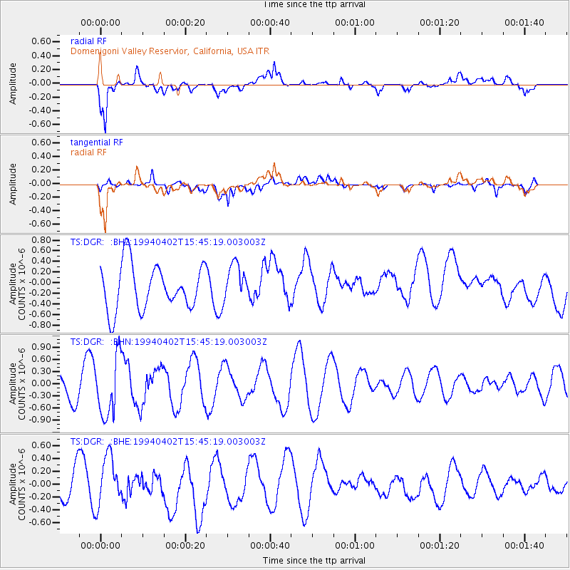
DGR Domenigoni Valley Reservior, California, USA - Earthquake Result Viewer
*The percent match for this event was below the threshold and hence no stack was calculated.
| Earthquake location: |
Fiji Islands Region |
| Earthquake latitude/longitude: |
-15.1/-177.6 |
| Earthquake time(UTC): |
1994/04/02 (092) 15:34:44 GMT |
| Earthquake Depth: |
354 km |
| Earthquake Magnitude: |
5.5 MB |
| Earthquake Catalog/Contributor: |
WHDF/NEIC |
|
| Network: |
TS TERRAscope (Southern California Seismic Network) |
| Station: |
DGR Domenigoni Valley Reservior, California, USA |
| Lat/Lon: |
33.65 N/117.01 W |
| Elevation: |
700 m |
|
| Distance: |
75.3 deg |
| Az: |
48.663 deg |
| Baz: |
240.393 deg |
| Ray Param: |
$rayparam |
*The percent match for this event was below the threshold and hence was not used in the summary stack. |
|
| Radial Match: |
66.06143 % |
| Radial Bump: |
400 |
| Transverse Match: |
63.278473 % |
| Transverse Bump: |
400 |
| SOD ConfigId: |
4480 |
| Insert Time: |
2010-02-26 14:11:30.032 +0000 |
| GWidth: |
2.5 |
| Max Bumps: |
400 |
| Tol: |
0.001 |
|
Signal To Noise
| Channel | StoN | STA | LTA |
| TS:DGR: :BHN:19940402T15:45:19.003003Z | 1.8413664 | 7.4880353E-7 | 4.0665645E-7 |
| TS:DGR: :BHE:19940402T15:45:19.003003Z | 1.8621004 | 3.6859404E-7 | 1.9794533E-7 |
| TS:DGR: :BHZ:19940402T15:45:19.003003Z | 0.8106521 | 3.4366832E-7 | 4.239406E-7 |
| Arrivals |
| Ps | |
| PpPs | |
| PsPs/PpSs | |


