You are here: Home > Network List > TA - USArray Transportable Network (new EarthScope stations) Stations List
> Station J15A Blackfoot, ID, USA > Earthquake Result Viewer
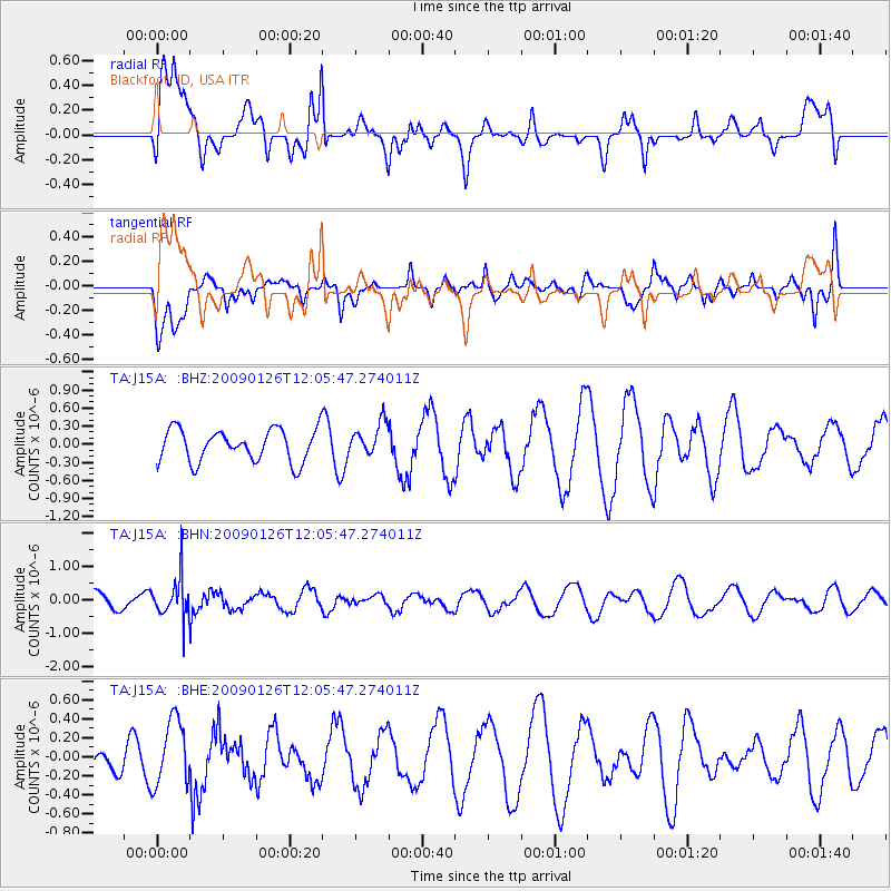
J15A Blackfoot, ID, USA - Earthquake Result Viewer
*The percent match for this event was below the threshold and hence no stack was calculated.
| Earthquake location: |
Fiji Islands Region |
| Earthquake latitude/longitude: |
-17.8/-178.6 |
| Earthquake time(UTC): |
2009/01/26 (026) 11:54:39 GMT |
| Earthquake Depth: |
580 km |
| Earthquake Magnitude: |
5.5 MB, 5.8 MW, 5.8 MW |
| Earthquake Catalog/Contributor: |
WHDF/NEIC |
|
| Network: |
TA USArray Transportable Network (new EarthScope stations) |
| Station: |
J15A Blackfoot, ID, USA |
| Lat/Lon: |
43.40 N/112.43 W |
| Elevation: |
1497 m |
|
| Distance: |
85.8 deg |
| Az: |
41.947 deg |
| Baz: |
240.898 deg |
| Ray Param: |
$rayparam |
*The percent match for this event was below the threshold and hence was not used in the summary stack. |
|
| Radial Match: |
53.534336 % |
| Radial Bump: |
400 |
| Transverse Match: |
59.857147 % |
| Transverse Bump: |
400 |
| SOD ConfigId: |
2658 |
| Insert Time: |
2010-03-06 21:57:37.011 +0000 |
| GWidth: |
2.5 |
| Max Bumps: |
400 |
| Tol: |
0.001 |
|
Signal To Noise
| Channel | StoN | STA | LTA |
| TA:J15A: :BHN:20090126T12:05:47.274011Z | 3.2642844 | 6.0296924E-7 | 1.8471714E-7 |
| TA:J15A: :BHE:20090126T12:05:47.274011Z | 0.67679286 | 3.4649736E-7 | 5.119696E-7 |
| TA:J15A: :BHZ:20090126T12:05:47.274011Z | 1.0228329 | 2.730161E-7 | 2.6692155E-7 |
| Arrivals |
| Ps | |
| PpPs | |
| PsPs/PpSs | |


