You are here: Home > Network List > TA - USArray Transportable Network (new EarthScope stations) Stations List
> Station H31M Peel River, Yukon, CAN > Earthquake Result Viewer
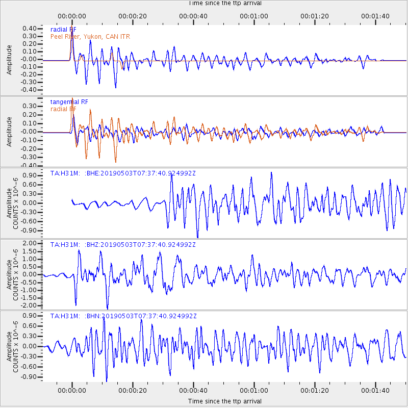
H31M Peel River, Yukon, CAN - Earthquake Result Viewer
*The percent match for this event was below the threshold and hence no stack was calculated.
| Earthquake location: |
Solomon Islands |
| Earthquake latitude/longitude: |
-6.9/160.1 |
| Earthquake time(UTC): |
2019/05/03 (123) 07:25:29 GMT |
| Earthquake Depth: |
10 km |
| Earthquake Magnitude: |
6.1 Mww |
| Earthquake Catalog/Contributor: |
NEIC PDE/us |
|
| Network: |
TA USArray Transportable Network (new EarthScope stations) |
| Station: |
H31M Peel River, Yukon, CAN |
| Lat/Lon: |
65.81 N/134.34 W |
| Elevation: |
642 m |
|
| Distance: |
86.6 deg |
| Az: |
22.076 deg |
| Baz: |
244.868 deg |
| Ray Param: |
$rayparam |
*The percent match for this event was below the threshold and hence was not used in the summary stack. |
|
| Radial Match: |
84.91825 % |
| Radial Bump: |
400 |
| Transverse Match: |
68.320755 % |
| Transverse Bump: |
400 |
| SOD ConfigId: |
18252611 |
| Insert Time: |
2019-05-17 07:31:58.905 +0000 |
| GWidth: |
2.5 |
| Max Bumps: |
400 |
| Tol: |
0.001 |
|
Signal To Noise
| Channel | StoN | STA | LTA |
| TA:H31M: :BHZ:20190503T07:37:40.924992Z | 8.935927 | 7.68343E-7 | 8.598358E-8 |
| TA:H31M: :BHN:20190503T07:37:40.924992Z | 2.549215 | 1.799376E-7 | 7.058549E-8 |
| TA:H31M: :BHE:20190503T07:37:40.924992Z | 5.3151035 | 4.2613735E-7 | 8.01748E-8 |
| Arrivals |
| Ps | |
| PpPs | |
| PsPs/PpSs | |


