You are here: Home > Network List > TA - USArray Transportable Network (new EarthScope stations) Stations List
> Station O17K Koliganek, Bristol Bay, AK, USA > Earthquake Result Viewer
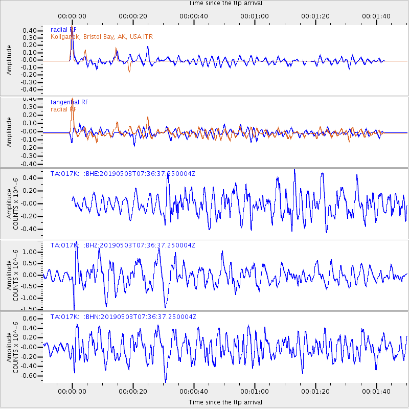
O17K Koliganek, Bristol Bay, AK, USA - Earthquake Result Viewer
*The percent match for this event was below the threshold and hence no stack was calculated.
| Earthquake location: |
Solomon Islands |
| Earthquake latitude/longitude: |
-6.9/160.1 |
| Earthquake time(UTC): |
2019/05/03 (123) 07:25:29 GMT |
| Earthquake Depth: |
10 km |
| Earthquake Magnitude: |
6.1 Mww |
| Earthquake Catalog/Contributor: |
NEIC PDE/us |
|
| Network: |
TA USArray Transportable Network (new EarthScope stations) |
| Station: |
O17K Koliganek, Bristol Bay, AK, USA |
| Lat/Lon: |
59.77 N/157.09 W |
| Elevation: |
156 m |
|
| Distance: |
74.6 deg |
| Az: |
20.883 deg |
| Baz: |
224.382 deg |
| Ray Param: |
$rayparam |
*The percent match for this event was below the threshold and hence was not used in the summary stack. |
|
| Radial Match: |
73.46169 % |
| Radial Bump: |
400 |
| Transverse Match: |
57.99095 % |
| Transverse Bump: |
400 |
| SOD ConfigId: |
18252611 |
| Insert Time: |
2019-05-17 07:32:35.724 +0000 |
| GWidth: |
2.5 |
| Max Bumps: |
400 |
| Tol: |
0.001 |
|
Signal To Noise
| Channel | StoN | STA | LTA |
| TA:O17K: :BHZ:20190503T07:36:37.250004Z | 5.649829 | 6.417483E-7 | 1.13587205E-7 |
| TA:O17K: :BHN:20190503T07:36:37.250004Z | 2.786372 | 2.5468145E-7 | 9.140253E-8 |
| TA:O17K: :BHE:20190503T07:36:37.250004Z | 2.0900247 | 2.123096E-7 | 1.01582344E-7 |
| Arrivals |
| Ps | |
| PpPs | |
| PsPs/PpSs | |


