You are here: Home > Network List > TA - USArray Transportable Network (new EarthScope stations) Stations List
> Station J15A Blackfoot, ID, USA > Earthquake Result Viewer
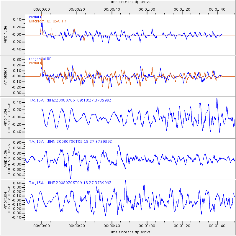
J15A Blackfoot, ID, USA - Earthquake Result Viewer
*The percent match for this event was below the threshold and hence no stack was calculated.
| Earthquake location: |
Kuril Islands |
| Earthquake latitude/longitude: |
45.4/151.0 |
| Earthquake time(UTC): |
2008/07/06 (188) 09:08:20 GMT |
| Earthquake Depth: |
10 km |
| Earthquake Magnitude: |
5.8 MB, 5.4 MS, 5.7 MW, 5.7 MW |
| Earthquake Catalog/Contributor: |
WHDF/NEIC |
|
| Network: |
TA USArray Transportable Network (new EarthScope stations) |
| Station: |
J15A Blackfoot, ID, USA |
| Lat/Lon: |
43.40 N/112.43 W |
| Elevation: |
1497 m |
|
| Distance: |
64.7 deg |
| Az: |
53.183 deg |
| Baz: |
309.287 deg |
| Ray Param: |
$rayparam |
*The percent match for this event was below the threshold and hence was not used in the summary stack. |
|
| Radial Match: |
67.004944 % |
| Radial Bump: |
400 |
| Transverse Match: |
64.28704 % |
| Transverse Bump: |
400 |
| SOD ConfigId: |
2504 |
| Insert Time: |
2010-03-06 21:58:03.036 +0000 |
| GWidth: |
2.5 |
| Max Bumps: |
400 |
| Tol: |
0.001 |
|
Signal To Noise
| Channel | StoN | STA | LTA |
| TA:J15A: :BHN:20080706T09:18:27.373999Z | 2.9141715 | 2.7093822E-7 | 9.2972634E-8 |
| TA:J15A: :BHE:20080706T09:18:27.373999Z | 1.4034629 | 1.11420725E-7 | 7.9389864E-8 |
| TA:J15A: :BHZ:20080706T09:18:27.373999Z | 0.41321674 | 6.6286795E-8 | 1.6041653E-7 |
| Arrivals |
| Ps | |
| PpPs | |
| PsPs/PpSs | |


