
E16A East Helena, MT, USA - Earthquake Result Viewer
| ||||||||||||||||||
| ||||||||||||||||||
| ||||||||||||||||||
|
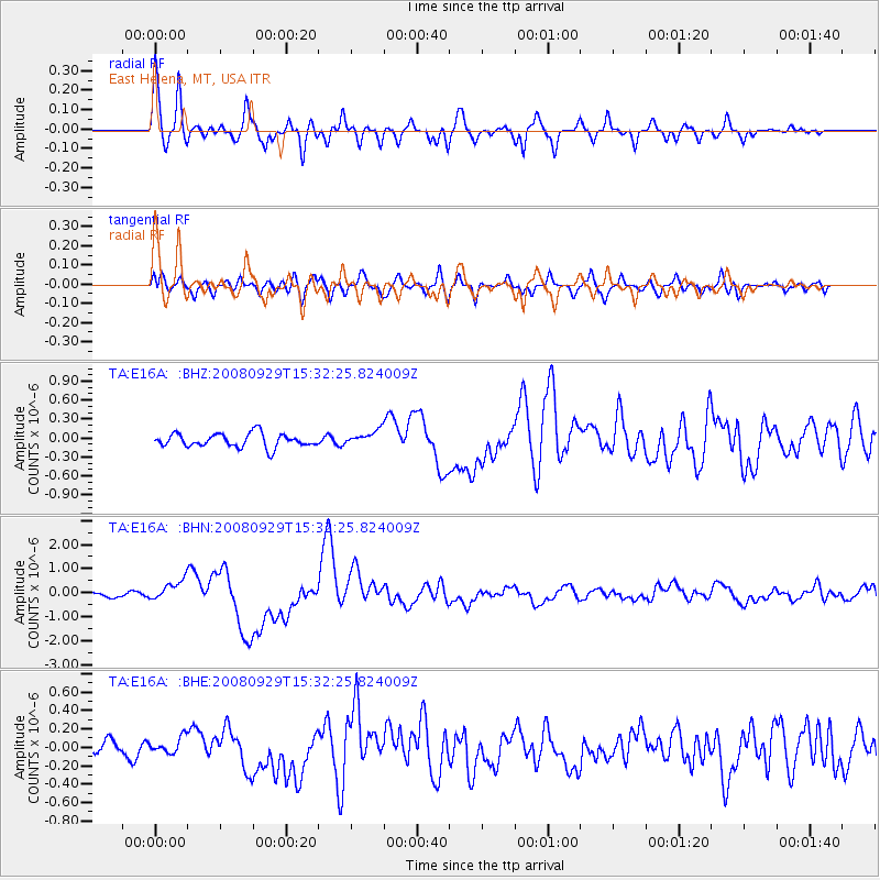
Signal To Noise
| Channel | StoN | STA | LTA |
| TA:E16A: :BHN:20080929T15:32:25.824009Z | 3.7269278 | 4.20765E-7 | 1.1289862E-7 |
| TA:E16A: :BHE:20080929T15:32:25.824009Z | 0.55412567 | 8.876411E-8 | 1.601877E-7 |
| TA:E16A: :BHZ:20080929T15:32:25.824009Z | 1.0894148 | 1.17670304E-7 | 1.08012394E-7 |
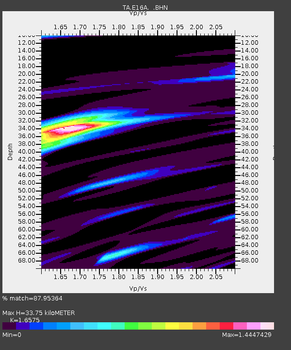
| Arrivals | |
| Ps | 3.6 SECOND |
| PpPs | 14 SECOND |
| PsPs/PpSs | 18 SECOND |

