
E16A East Helena, MT, USA - Earthquake Result Viewer
| ||||||||||||||||||
| ||||||||||||||||||
| ||||||||||||||||||
|
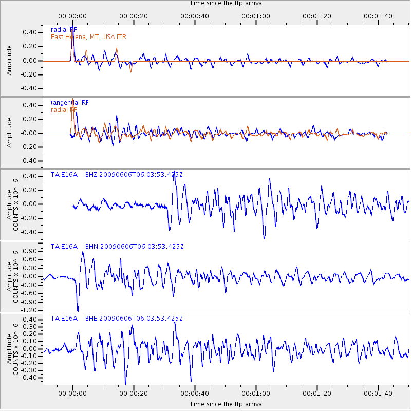
Signal To Noise
| Channel | StoN | STA | LTA |
| TA:E16A: :BHN:20090606T06:03:53.425Z | 13.671257 | 5.445969E-7 | 3.983517E-8 |
| TA:E16A: :BHE:20090606T06:03:53.425Z | 2.4317575 | 1.18121E-7 | 4.8574332E-8 |
| TA:E16A: :BHZ:20090606T06:03:53.425Z | 6.3121285 | 2.2680716E-7 | 3.593196E-8 |
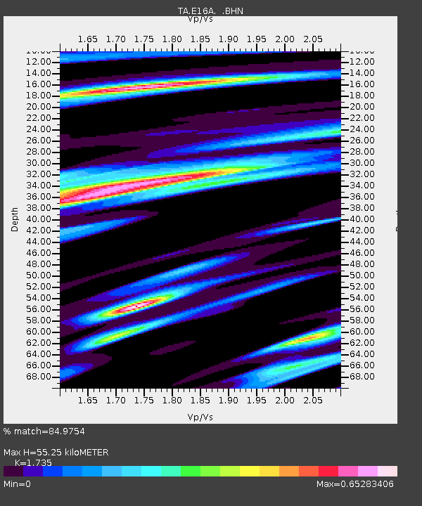
| Arrivals | |
| Ps | 6.6 SECOND |
| PpPs | 23 SECOND |
| PsPs/PpSs | 30 SECOND |

