E16A East Helena, MT, USA - Earthquake Result Viewer
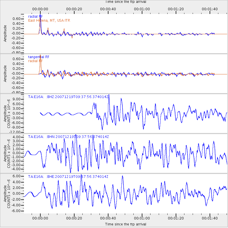
Earthquake location: Andreanof Islands, Aleutian Is.
Earthquake latitude/longitude: 51.4/-179.5
Earthquake time(UTC): 2007/12/19 (353) 09:30:27 GMT
Earthquake Depth: 29 km
Earthquake Magnitude: 6.4 MB, 7.1 MS, 7.1 MW, 7.0 MW
Earthquake Catalog/Contributor: WHDF/NEIC
Network: TA USArray Transportable Network (new EarthScope stations)
Station: E16A East Helena, MT, USA
Lat/Lon: 46.53 N/111.68 W
Elevation: 1398 m
Distance: 43.4 deg
Az: 68.586 deg
Baz: 302.28 deg
Ray Param: 0.072535165
Estimated Moho Depth: 33.75 km
Estimated Crust Vp/Vs: 1.75
Assumed Crust Vp: 6.306 km/s
Estimated Crust Vs: 3.598 km/s
Estimated Crust Poisson's Ratio: 0.26
Radial Match: 93.26794 %
Radial Bump: 364
Transverse Match: 74.116646 %
Transverse Bump: 400
SOD ConfigId: 2564
Insert Time: 2010-03-06 21:59:32.856 +0000
GWidth: 2.5
Max Bumps: 400
Tol: 0.001

Signal To Noise

ChannelStoNSTALTA
TA:E16A: :BHN:20071219T09:37:56.374014Z3.80567721.901592E-64.996724E-7
TA:E16A: :BHE:20071219T09:37:56.374014Z3.16102311.8992438E-66.00832E-7
TA:E16A: :BHZ:20071219T09:37:56.374014Z6.53961133.502723E-65.356164E-7
Arrivals
Ps4.3 SECOND
PpPs14 SECOND
PsPs/PpSs18 SECOND