E16A East Helena, MT, USA - Earthquake Result Viewer
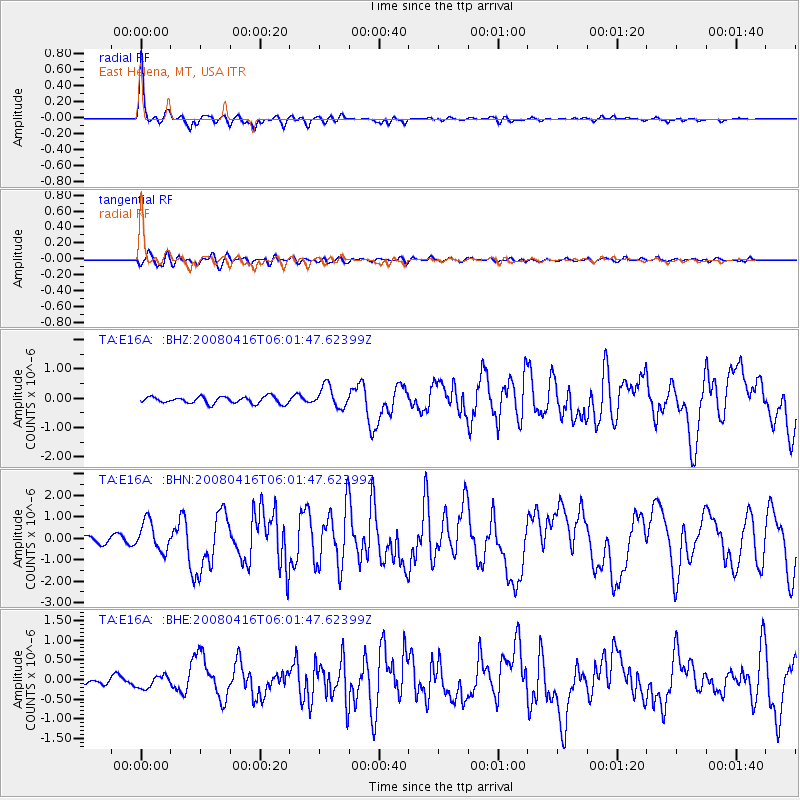
Earthquake location: Andreanof Islands, Aleutian Is.
Earthquake latitude/longitude: 51.9/-179.2
Earthquake time(UTC): 2008/04/16 (107) 05:54:19 GMT
Earthquake Depth: 13 km
Earthquake Magnitude: 6.1 MB, 6.5 MS, 6.6 MW, 6.6 MW
Earthquake Catalog/Contributor: WHDF/NEIC
Network: TA USArray Transportable Network (new EarthScope stations)
Station: E16A East Helena, MT, USA
Lat/Lon: 46.53 N/111.68 W
Elevation: 1398 m
Distance: 43.0 deg
Az: 69.293 deg
Baz: 302.867 deg
Ray Param: 0.07283429
Estimated Moho Depth: 23.25 km
Estimated Crust Vp/Vs: 2.10
Assumed Crust Vp: 6.306 km/s
Estimated Crust Vs: 3.01 km/s
Estimated Crust Poisson's Ratio: 0.35
Radial Match: 94.47016 %
Radial Bump: 326
Transverse Match: 72.797516 %
Transverse Bump: 400
SOD ConfigId: 2504
Insert Time: 2010-03-06 21:59:51.678 +0000
GWidth: 2.5
Max Bumps: 400
Tol: 0.001

Signal To Noise

ChannelStoNSTALTA
TA:E16A: :BHN:20080416T06:01:47.62399Z5.6555896.8336675E-71.2083034E-7
TA:E16A: :BHE:20080416T06:01:47.62399Z1.87198671.5406339E-78.22994E-8
TA:E16A: :BHZ:20080416T06:01:47.62399Z3.18672373.692471E-71.1587044E-7
Arrivals
Ps4.3 SECOND
PpPs11 SECOND
PsPs/PpSs15 SECOND