E16A East Helena, MT, USA - Earthquake Result Viewer
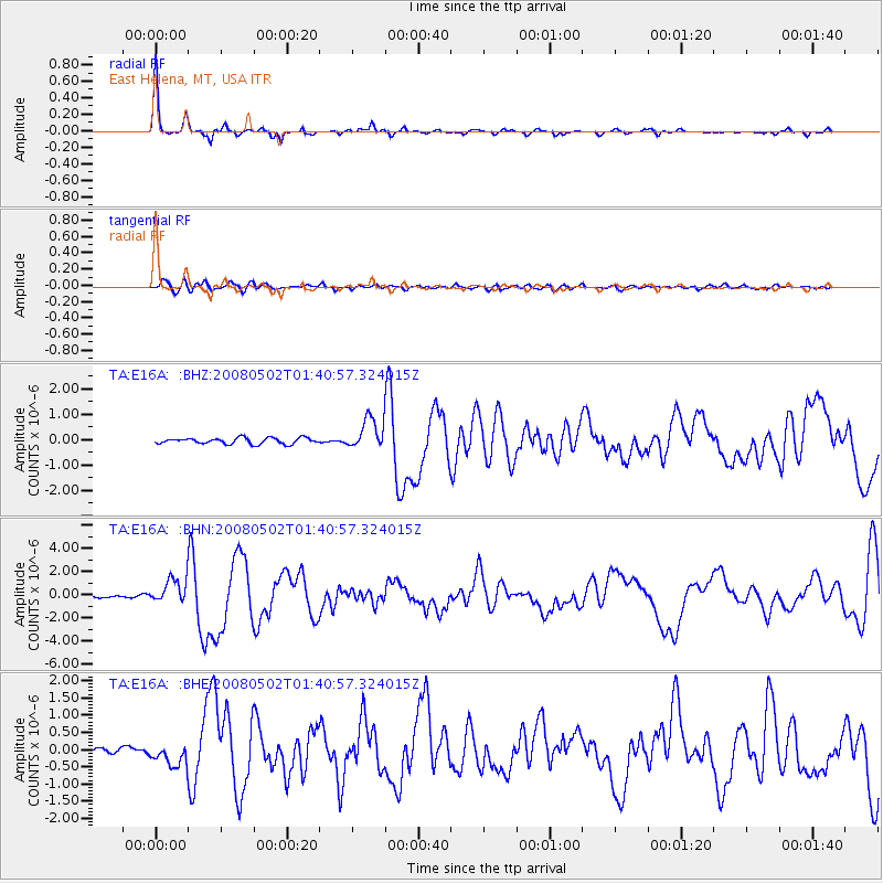
Earthquake location: Andreanof Islands, Aleutian Is.
Earthquake latitude/longitude: 51.9/-177.5
Earthquake time(UTC): 2008/05/02 (123) 01:33:37 GMT
Earthquake Depth: 14 km
Earthquake Magnitude: 6.3 MB, 6.8 MS, 6.6 MW, 6.6 MW
Earthquake Catalog/Contributor: WHDF/NEIC
Network: TA USArray Transportable Network (new EarthScope stations)
Station: E16A East Helena, MT, USA
Lat/Lon: 46.53 N/111.68 W
Elevation: 1398 m
Distance: 42.0 deg
Az: 70.18 deg
Baz: 302.327 deg
Ray Param: 0.07339964
Estimated Moho Depth: 34.25 km
Estimated Crust Vp/Vs: 1.83
Assumed Crust Vp: 6.306 km/s
Estimated Crust Vs: 3.446 km/s
Estimated Crust Poisson's Ratio: 0.29
Radial Match: 94.797356 %
Radial Bump: 242
Transverse Match: 68.08972 %
Transverse Bump: 400
SOD ConfigId: 2504
Insert Time: 2010-03-06 21:59:54.290 +0000
GWidth: 2.5
Max Bumps: 400
Tol: 0.001

Signal To Noise

ChannelStoNSTALTA
TA:E16A: :BHN:20080502T01:40:57.324015Z10.5560851.0610391E-61.0051446E-7
TA:E16A: :BHE:20080502T01:40:57.324015Z2.8952663.2656723E-71.12793515E-7
TA:E16A: :BHZ:20080502T01:40:57.324015Z5.2361156.1166645E-71.1681684E-7
Arrivals
Ps4.8 SECOND
PpPs14 SECOND
PsPs/PpSs19 SECOND