You are here: Home > Network List > TA - USArray Transportable Network (new EarthScope stations) Stations List
> Station E20K Nigu River, AK, USA > Earthquake Result Viewer
E20K Nigu River, AK, USA - Earthquake Result Viewer
*The percent match for this event was below the threshold and hence no stack was calculated.
| Earthquake location: |
Mindoro, Philippines |
| Earthquake latitude/longitude: |
12.4/120.9 |
| Earthquake time(UTC): |
2019/05/04 (124) 01:05:09 GMT |
| Earthquake Depth: |
10 km |
| Earthquake Magnitude: |
5.7 Mww |
| Earthquake Catalog/Contributor: |
NEIC PDE/us |
|
| Network: |
TA USArray Transportable Network (new EarthScope stations) |
| Station: |
E20K Nigu River, AK, USA |
| Lat/Lon: |
68.26 N/156.19 W |
| Elevation: |
866 m |
|
| Distance: |
75.9 deg |
| Az: |
22.405 deg |
| Baz: |
268.076 deg |
| Ray Param: |
$rayparam |
*The percent match for this event was below the threshold and hence was not used in the summary stack. |
|
| Radial Match: |
67.053986 % |
| Radial Bump: |
400 |
| Transverse Match: |
65.54064 % |
| Transverse Bump: |
400 |
| SOD ConfigId: |
18252611 |
| Insert Time: |
2019-05-18 01:07:49.486 +0000 |
| GWidth: |
2.5 |
| Max Bumps: |
400 |
| Tol: |
0.001 |
|
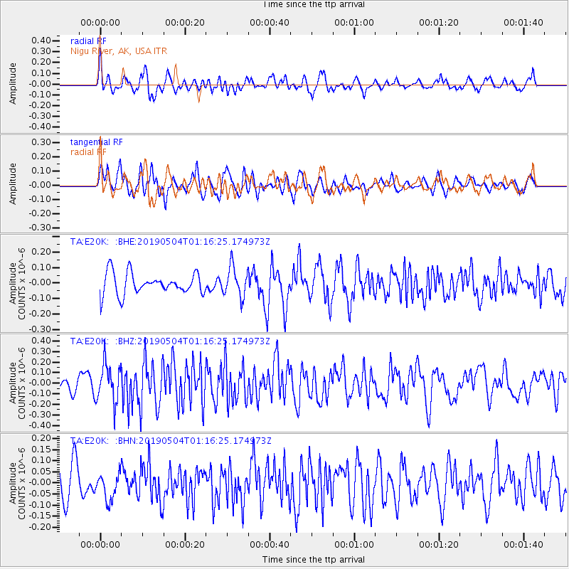
Signal To Noise
| Channel | StoN | STA | LTA |
| TA:E20K: :BHZ:20190504T01:16:25.174973Z | 2.8347123 | 1.8259605E-7 | 6.4414316E-8 |
| TA:E20K: :BHN:20190504T01:16:25.174973Z | 0.9025845 | 6.3401714E-8 | 7.024463E-8 |
| TA:E20K: :BHE:20190504T01:16:25.174973Z | 1.4199038 | 9.888995E-8 | 6.964553E-8 |
| Arrivals |
| Ps | |
| PpPs | |
| PsPs/PpSs | |


