You are here: Home > Network List > TA - USArray Transportable Network (new EarthScope stations) Stations List
> Station E16A East Helena, MT, USA > Earthquake Result Viewer
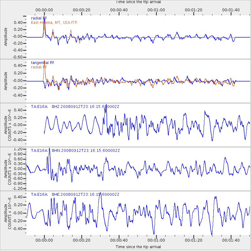
E16A East Helena, MT, USA - Earthquake Result Viewer
*The percent match for this event was below the threshold and hence no stack was calculated.
| Earthquake location: |
Komandorskiye Ostrova Region |
| Earthquake latitude/longitude: |
56.3/164.1 |
| Earthquake time(UTC): |
2008/09/12 (256) 23:07:50 GMT |
| Earthquake Depth: |
9.3 km |
| Earthquake Magnitude: |
5.5 MB, 5.7 MS, 5.9 MW, 5.9 MW |
| Earthquake Catalog/Contributor: |
WHDF/NEIC |
|
| Network: |
TA USArray Transportable Network (new EarthScope stations) |
| Station: |
E16A East Helena, MT, USA |
| Lat/Lon: |
46.53 N/111.68 W |
| Elevation: |
1398 m |
|
| Distance: |
50.3 deg |
| Az: |
63.288 deg |
| Baz: |
313.85 deg |
| Ray Param: |
$rayparam |
*The percent match for this event was below the threshold and hence was not used in the summary stack. |
|
| Radial Match: |
68.078545 % |
| Radial Bump: |
400 |
| Transverse Match: |
61.578644 % |
| Transverse Bump: |
400 |
| SOD ConfigId: |
2560 |
| Insert Time: |
2010-03-06 22:01:09.957 +0000 |
| GWidth: |
2.5 |
| Max Bumps: |
400 |
| Tol: |
0.001 |
|
Signal To Noise
| Channel | StoN | STA | LTA |
| TA:E16A: :BHN:20080912T23:16:15.600002Z | 3.1459694 | 4.927444E-7 | 1.5662721E-7 |
| TA:E16A: :BHE:20080912T23:16:15.600002Z | 1.6697732 | 1.93938E-7 | 1.1614632E-7 |
| TA:E16A: :BHZ:20080912T23:16:15.600002Z | 1.8879699 | 2.4576764E-7 | 1.3017561E-7 |
| Arrivals |
| Ps | |
| PpPs | |
| PsPs/PpSs | |


