You are here: Home > Network List > PF - Volcanologic Network of Piton de Fournaise-OVPF Stations List
> Station HIM cratere Himiltrude > Earthquake Result Viewer
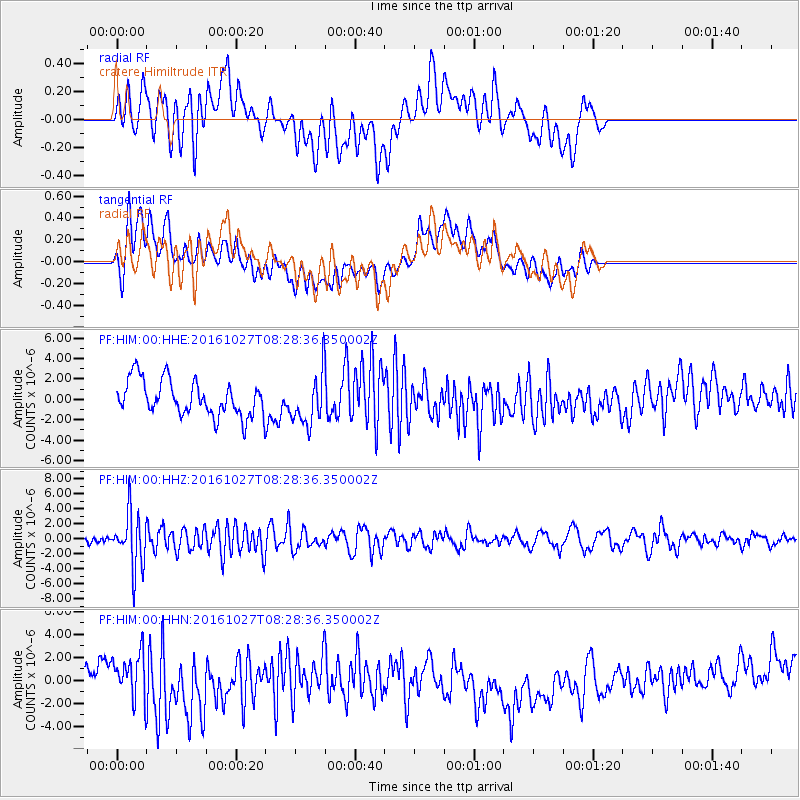
HIM cratere Himiltrude - Earthquake Result Viewer
*The percent match for this event was below the threshold and hence no stack was calculated.
| Earthquake location: |
Northern Molucca Sea |
| Earthquake latitude/longitude: |
1.3/125.8 |
| Earthquake time(UTC): |
2016/10/27 (301) 08:17:49 GMT |
| Earthquake Depth: |
56 km |
| Earthquake Magnitude: |
5.9 MB, 5.8 MWB |
| Earthquake Catalog/Contributor: |
NEIC PDE/NEIC COMCAT |
|
| Network: |
PF Volcanologic Network of Piton de Fournaise-OVPF |
| Station: |
HIM cratere Himiltrude |
| Lat/Lon: |
21.21 S/55.72 E |
| Elevation: |
1958 m |
|
| Distance: |
72.0 deg |
| Az: |
247.301 deg |
| Baz: |
81.286 deg |
| Ray Param: |
$rayparam |
*The percent match for this event was below the threshold and hence was not used in the summary stack. |
|
| Radial Match: |
48.65025 % |
| Radial Bump: |
400 |
| Transverse Match: |
33.800465 % |
| Transverse Bump: |
400 |
| SOD ConfigId: |
1815711 |
| Insert Time: |
2016-11-10 08:22:06.451 +0000 |
| GWidth: |
2.5 |
| Max Bumps: |
400 |
| Tol: |
0.001 |
|
Signal To Noise
| Channel | StoN | STA | LTA |
| PF:HIM:00:HHZ:20161027T08:28:36.350002Z | 4.439561 | 3.6659912E-6 | 8.257554E-7 |
| PF:HIM:00:HHN:20161027T08:28:36.350002Z | 1.5489484 | 2.0306563E-6 | 1.3109903E-6 |
| PF:HIM:00:HHE:20161027T08:28:36.350002Z | 1.4221269 | 2.4436324E-6 | 1.7182942E-6 |
| Arrivals |
| Ps | |
| PpPs | |
| PsPs/PpSs | |


