You are here: Home > Network List > TA - USArray Transportable Network (new EarthScope stations) Stations List
> Station E16A East Helena, MT, USA > Earthquake Result Viewer
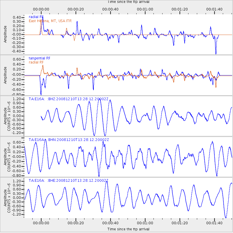
E16A East Helena, MT, USA - Earthquake Result Viewer
*The percent match for this event was below the threshold and hence no stack was calculated.
| Earthquake location: |
Santa Cruz Islands |
| Earthquake latitude/longitude: |
-12.3/166.6 |
| Earthquake time(UTC): |
2008/12/10 (345) 13:15:34 GMT |
| Earthquake Depth: |
51 km |
| Earthquake Magnitude: |
5.7 MB, 6.0 MW, 6.0 MW |
| Earthquake Catalog/Contributor: |
WHDF/NEIC |
|
| Network: |
TA USArray Transportable Network (new EarthScope stations) |
| Station: |
E16A East Helena, MT, USA |
| Lat/Lon: |
46.53 N/111.68 W |
| Elevation: |
1398 m |
|
| Distance: |
93.3 deg |
| Az: |
43.182 deg |
| Baz: |
255.618 deg |
| Ray Param: |
$rayparam |
*The percent match for this event was below the threshold and hence was not used in the summary stack. |
|
| Radial Match: |
64.94447 % |
| Radial Bump: |
370 |
| Transverse Match: |
66.23945 % |
| Transverse Bump: |
400 |
| SOD ConfigId: |
2658 |
| Insert Time: |
2010-03-06 22:01:40.668 +0000 |
| GWidth: |
2.5 |
| Max Bumps: |
400 |
| Tol: |
0.001 |
|
Signal To Noise
| Channel | StoN | STA | LTA |
| TA:E16A: :BHN:20081210T13:28:12.20002Z | 0.78812 | 4.839388E-7 | 6.1404205E-7 |
| TA:E16A: :BHE:20081210T13:28:12.20002Z | 0.8378888 | 4.2374603E-7 | 5.0573067E-7 |
| TA:E16A: :BHZ:20081210T13:28:12.20002Z | 2.3170822 | 9.473432E-7 | 4.088518E-7 |
| Arrivals |
| Ps | |
| PpPs | |
| PsPs/PpSs | |


