You are here: Home > Network List > TA - USArray Transportable Network (new EarthScope stations) Stations List
> Station E18K Tukpahlearik Creek, AK, USA > Earthquake Result Viewer
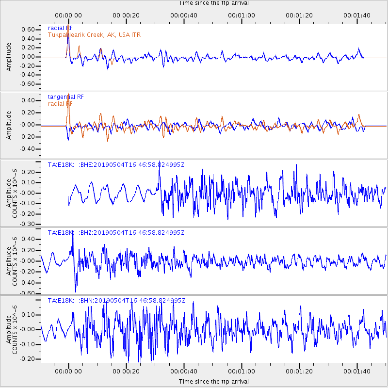
E18K Tukpahlearik Creek, AK, USA - Earthquake Result Viewer
*The percent match for this event was below the threshold and hence no stack was calculated.
| Earthquake location: |
Kuril Islands |
| Earthquake latitude/longitude: |
43.2/146.4 |
| Earthquake time(UTC): |
2019/05/04 (124) 16:40:25 GMT |
| Earthquake Depth: |
59 km |
| Earthquake Magnitude: |
5.1 Mww |
| Earthquake Catalog/Contributor: |
NEIC PDE/us |
|
| Network: |
TA USArray Transportable Network (new EarthScope stations) |
| Station: |
E18K Tukpahlearik Creek, AK, USA |
| Lat/Lon: |
67.42 N/160.60 W |
| Elevation: |
297 m |
|
| Distance: |
37.0 deg |
| Az: |
30.842 deg |
| Baz: |
256.226 deg |
| Ray Param: |
$rayparam |
*The percent match for this event was below the threshold and hence was not used in the summary stack. |
|
| Radial Match: |
67.18003 % |
| Radial Bump: |
400 |
| Transverse Match: |
47.1677 % |
| Transverse Bump: |
400 |
| SOD ConfigId: |
18252611 |
| Insert Time: |
2019-05-18 16:46:36.045 +0000 |
| GWidth: |
2.5 |
| Max Bumps: |
400 |
| Tol: |
0.001 |
|
Signal To Noise
| Channel | StoN | STA | LTA |
| TA:E18K: :BHZ:20190504T16:46:58.824995Z | 3.05939 | 2.1855747E-7 | 7.143825E-8 |
| TA:E18K: :BHN:20190504T16:46:58.824995Z | 1.0948404 | 6.036624E-8 | 5.5137022E-8 |
| TA:E18K: :BHE:20190504T16:46:58.824995Z | 1.5746781 | 9.461279E-8 | 6.008389E-8 |
| Arrivals |
| Ps | |
| PpPs | |
| PsPs/PpSs | |


