You are here: Home > Network List > TA - USArray Transportable Network (new EarthScope stations) Stations List
> Station F21K Alatna River, AK, USA > Earthquake Result Viewer
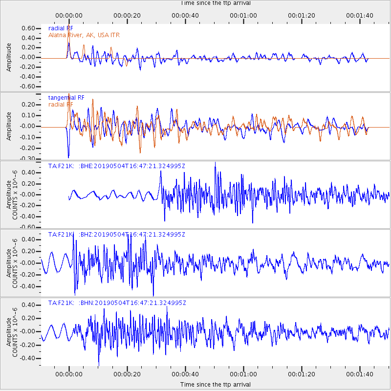
F21K Alatna River, AK, USA - Earthquake Result Viewer
*The percent match for this event was below the threshold and hence no stack was calculated.
| Earthquake location: |
Kuril Islands |
| Earthquake latitude/longitude: |
43.2/146.4 |
| Earthquake time(UTC): |
2019/05/04 (124) 16:40:25 GMT |
| Earthquake Depth: |
59 km |
| Earthquake Magnitude: |
5.1 Mww |
| Earthquake Catalog/Contributor: |
NEIC PDE/us |
|
| Network: |
TA USArray Transportable Network (new EarthScope stations) |
| Station: |
F21K Alatna River, AK, USA |
| Lat/Lon: |
67.22 N/153.48 W |
| Elevation: |
597 m |
|
| Distance: |
39.6 deg |
| Az: |
31.937 deg |
| Baz: |
263.65 deg |
| Ray Param: |
$rayparam |
*The percent match for this event was below the threshold and hence was not used in the summary stack. |
|
| Radial Match: |
51.78361 % |
| Radial Bump: |
400 |
| Transverse Match: |
70.52943 % |
| Transverse Bump: |
400 |
| SOD ConfigId: |
18252611 |
| Insert Time: |
2019-05-18 16:46:46.034 +0000 |
| GWidth: |
2.5 |
| Max Bumps: |
400 |
| Tol: |
0.001 |
|
Signal To Noise
| Channel | StoN | STA | LTA |
| TA:F21K: :BHZ:20190504T16:47:21.324995Z | 2.2778218 | 2.2264109E-7 | 9.7742976E-8 |
| TA:F21K: :BHN:20190504T16:47:21.324995Z | 1.2269257 | 7.335738E-8 | 5.9789585E-8 |
| TA:F21K: :BHE:20190504T16:47:21.324995Z | 3.735051 | 1.7546247E-7 | 4.6977267E-8 |
| Arrivals |
| Ps | |
| PpPs | |
| PsPs/PpSs | |


