You are here: Home > Network List > TA - USArray Transportable Network (new EarthScope stations) Stations List
> Station E16A East Helena, MT, USA > Earthquake Result Viewer
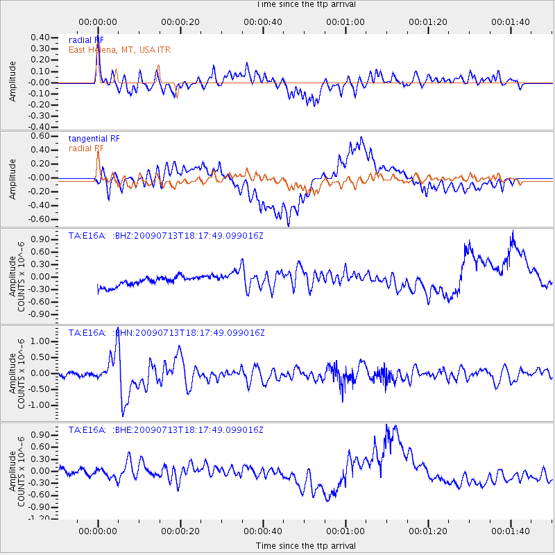
E16A East Helena, MT, USA - Earthquake Result Viewer
*The percent match for this event was below the threshold and hence no stack was calculated.
| Earthquake location: |
Taiwan Region |
| Earthquake latitude/longitude: |
24.1/122.2 |
| Earthquake time(UTC): |
2009/07/13 (194) 18:05:01 GMT |
| Earthquake Depth: |
17 km |
| Earthquake Magnitude: |
6.1 MB, 6.3 MS, 6.3 MW, 6.2 MW |
| Earthquake Catalog/Contributor: |
WHDF/NEIC |
|
| Network: |
TA USArray Transportable Network (new EarthScope stations) |
| Station: |
E16A East Helena, MT, USA |
| Lat/Lon: |
46.53 N/111.68 W |
| Elevation: |
1398 m |
|
| Distance: |
94.5 deg |
| Az: |
34.013 deg |
| Baz: |
312.207 deg |
| Ray Param: |
$rayparam |
*The percent match for this event was below the threshold and hence was not used in the summary stack. |
|
| Radial Match: |
68.72558 % |
| Radial Bump: |
400 |
| Transverse Match: |
67.96674 % |
| Transverse Bump: |
400 |
| SOD ConfigId: |
2648 |
| Insert Time: |
2010-03-06 22:02:00.437 +0000 |
| GWidth: |
2.5 |
| Max Bumps: |
400 |
| Tol: |
0.001 |
|
Signal To Noise
| Channel | StoN | STA | LTA |
| TA:E16A: :BHN:20090713T18:17:49.099016Z | 7.413343 | 5.024667E-7 | 6.77787E-8 |
| TA:E16A: :BHE:20090713T18:17:49.099016Z | 1.5710838 | 1.13884965E-7 | 7.2488156E-8 |
| TA:E16A: :BHZ:20090713T18:17:49.099016Z | 2.0248952 | 2.207557E-7 | 1.09020796E-7 |
| Arrivals |
| Ps | |
| PpPs | |
| PsPs/PpSs | |


