You are here: Home > Network List > TA - USArray Transportable Network (new EarthScope stations) Stations List
> Station E16A East Helena, MT, USA > Earthquake Result Viewer
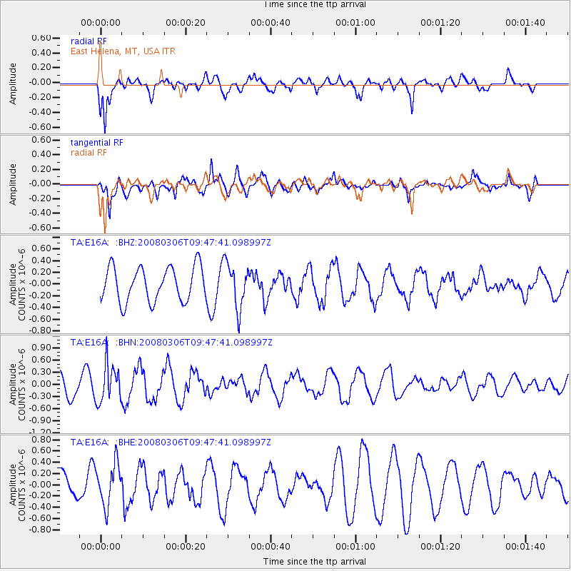
E16A East Helena, MT, USA - Earthquake Result Viewer
*The percent match for this event was below the threshold and hence no stack was calculated.
| Earthquake location: |
Kamchatka Peninsula, Russia |
| Earthquake latitude/longitude: |
51.5/156.5 |
| Earthquake time(UTC): |
2008/03/06 (066) 09:38:43 GMT |
| Earthquake Depth: |
134 km |
| Earthquake Magnitude: |
5.6 MB, 5.5 MW, 5.5 MW |
| Earthquake Catalog/Contributor: |
WHDF/NEIC |
|
| Network: |
TA USArray Transportable Network (new EarthScope stations) |
| Station: |
E16A East Helena, MT, USA |
| Lat/Lon: |
46.53 N/111.68 W |
| Elevation: |
1398 m |
|
| Distance: |
56.5 deg |
| Az: |
55.812 deg |
| Baz: |
311.529 deg |
| Ray Param: |
$rayparam |
*The percent match for this event was below the threshold and hence was not used in the summary stack. |
|
| Radial Match: |
69.59953 % |
| Radial Bump: |
400 |
| Transverse Match: |
78.79733 % |
| Transverse Bump: |
400 |
| SOD ConfigId: |
2504 |
| Insert Time: |
2010-03-06 22:02:02.019 +0000 |
| GWidth: |
2.5 |
| Max Bumps: |
400 |
| Tol: |
0.001 |
|
Signal To Noise
| Channel | StoN | STA | LTA |
| TA:E16A: :BHN:20080306T09:47:41.098997Z | 1.8002204 | 4.644362E-7 | 2.5798852E-7 |
| TA:E16A: :BHE:20080306T09:47:41.098997Z | 1.6411003 | 3.7444758E-7 | 2.2816862E-7 |
| TA:E16A: :BHZ:20080306T09:47:41.098997Z | 1.3080555 | 3.8154732E-7 | 2.9169047E-7 |
| Arrivals |
| Ps | |
| PpPs | |
| PsPs/PpSs | |


