You are here: Home > Network List > TA - USArray Transportable Network (new EarthScope stations) Stations List
> Station E16A East Helena, MT, USA > Earthquake Result Viewer
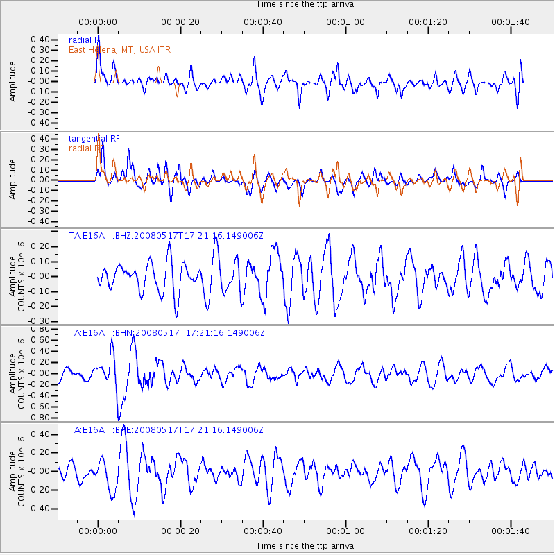
E16A East Helena, MT, USA - Earthquake Result Viewer
*The percent match for this event was below the threshold and hence no stack was calculated.
| Earthquake location: |
Sichuan, China |
| Earthquake latitude/longitude: |
32.2/105.0 |
| Earthquake time(UTC): |
2008/05/17 (138) 17:08:25 GMT |
| Earthquake Depth: |
9.0 km |
| Earthquake Magnitude: |
5.8 MB, 5.6 MS, 5.7 MW, 5.7 MW |
| Earthquake Catalog/Contributor: |
WHDF/NEIC |
|
| Network: |
TA USArray Transportable Network (new EarthScope stations) |
| Station: |
E16A East Helena, MT, USA |
| Lat/Lon: |
46.53 N/111.68 W |
| Elevation: |
1398 m |
|
| Distance: |
94.9 deg |
| Az: |
24.436 deg |
| Baz: |
329.483 deg |
| Ray Param: |
$rayparam |
*The percent match for this event was below the threshold and hence was not used in the summary stack. |
|
| Radial Match: |
63.35835 % |
| Radial Bump: |
400 |
| Transverse Match: |
63.616524 % |
| Transverse Bump: |
400 |
| SOD ConfigId: |
2504 |
| Insert Time: |
2010-03-06 22:02:14.613 +0000 |
| GWidth: |
2.5 |
| Max Bumps: |
400 |
| Tol: |
0.001 |
|
Signal To Noise
| Channel | StoN | STA | LTA |
| TA:E16A: :BHN:20080517T17:21:16.149006Z | 3.2069001 | 2.8210835E-7 | 8.796916E-8 |
| TA:E16A: :BHE:20080517T17:21:16.149006Z | 1.6360519 | 1.6843211E-7 | 1.02950345E-7 |
| TA:E16A: :BHZ:20080517T17:21:16.149006Z | 1.163767 | 1.06850955E-7 | 9.1814734E-8 |
| Arrivals |
| Ps | |
| PpPs | |
| PsPs/PpSs | |


