You are here: Home > Network List > TA - USArray Transportable Network (new EarthScope stations) Stations List
> Station E16A East Helena, MT, USA > Earthquake Result Viewer
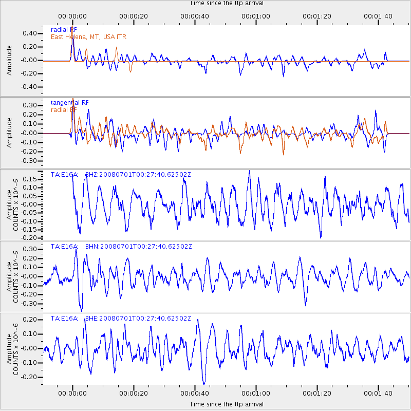
E16A East Helena, MT, USA - Earthquake Result Viewer
*The percent match for this event was below the threshold and hence no stack was calculated.
| Earthquake location: |
Central Peru |
| Earthquake latitude/longitude: |
-10.4/-75.5 |
| Earthquake time(UTC): |
2008/07/01 (183) 00:17:33 GMT |
| Earthquake Depth: |
33 km |
| Earthquake Magnitude: |
5.5 MW, 5.0 MS, 5.4 MB, 5.3 ML |
| Earthquake Catalog/Contributor: |
WHDF/NEIC |
|
| Network: |
TA USArray Transportable Network (new EarthScope stations) |
| Station: |
E16A East Helena, MT, USA |
| Lat/Lon: |
46.53 N/111.68 W |
| Elevation: |
1398 m |
|
| Distance: |
65.2 deg |
| Az: |
333.342 deg |
| Baz: |
140.25 deg |
| Ray Param: |
$rayparam |
*The percent match for this event was below the threshold and hence was not used in the summary stack. |
|
| Radial Match: |
52.304054 % |
| Radial Bump: |
400 |
| Transverse Match: |
52.733814 % |
| Transverse Bump: |
400 |
| SOD ConfigId: |
2504 |
| Insert Time: |
2010-03-06 22:02:15.428 +0000 |
| GWidth: |
2.5 |
| Max Bumps: |
400 |
| Tol: |
0.001 |
|
Signal To Noise
| Channel | StoN | STA | LTA |
| TA:E16A: :BHN:20080701T00:27:40.62502Z | 2.387192 | 2.0757349E-7 | 8.6952994E-8 |
| TA:E16A: :BHE:20080701T00:27:40.62502Z | 1.0716615 | 8.747165E-8 | 8.162246E-8 |
| TA:E16A: :BHZ:20080701T00:27:40.62502Z | 0.6669541 | 5.4698095E-8 | 8.201178E-8 |
| Arrivals |
| Ps | |
| PpPs | |
| PsPs/PpSs | |


