You are here: Home > Network List > TA - USArray Transportable Network (new EarthScope stations) Stations List
> Station E16A East Helena, MT, USA > Earthquake Result Viewer
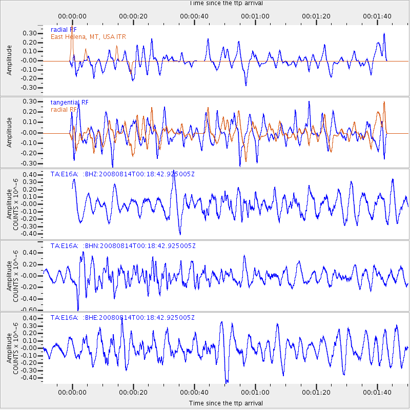
E16A East Helena, MT, USA - Earthquake Result Viewer
*The percent match for this event was below the threshold and hence no stack was calculated.
| Earthquake location: |
Mariana Islands |
| Earthquake latitude/longitude: |
16.4/146.9 |
| Earthquake time(UTC): |
2008/08/14 (227) 00:06:40 GMT |
| Earthquake Depth: |
53 km |
| Earthquake Magnitude: |
5.5 MB, 4.8 MS |
| Earthquake Catalog/Contributor: |
WHDF/NEIC |
|
| Network: |
TA USArray Transportable Network (new EarthScope stations) |
| Station: |
E16A East Helena, MT, USA |
| Lat/Lon: |
46.53 N/111.68 W |
| Elevation: |
1398 m |
|
| Distance: |
85.8 deg |
| Az: |
42.73 deg |
| Baz: |
289.396 deg |
| Ray Param: |
$rayparam |
*The percent match for this event was below the threshold and hence was not used in the summary stack. |
|
| Radial Match: |
53.1734 % |
| Radial Bump: |
400 |
| Transverse Match: |
62.49094 % |
| Transverse Bump: |
400 |
| SOD ConfigId: |
2504 |
| Insert Time: |
2010-03-06 22:02:19.754 +0000 |
| GWidth: |
2.5 |
| Max Bumps: |
400 |
| Tol: |
0.001 |
|
Signal To Noise
| Channel | StoN | STA | LTA |
| TA:E16A: :BHN:20080814T00:18:42.925005Z | 3.3295736 | 2.672882E-7 | 8.0277005E-8 |
| TA:E16A: :BHE:20080814T00:18:42.925005Z | 1.2457256 | 1.07617495E-7 | 8.6389406E-8 |
| TA:E16A: :BHZ:20080814T00:18:42.925005Z | 1.5731877 | 2.0058522E-7 | 1.2750242E-7 |
| Arrivals |
| Ps | |
| PpPs | |
| PsPs/PpSs | |


