You are here: Home > Network List > G - GEOSCOPE Stations List
> Station INU Inuyama, Japan > Earthquake Result Viewer
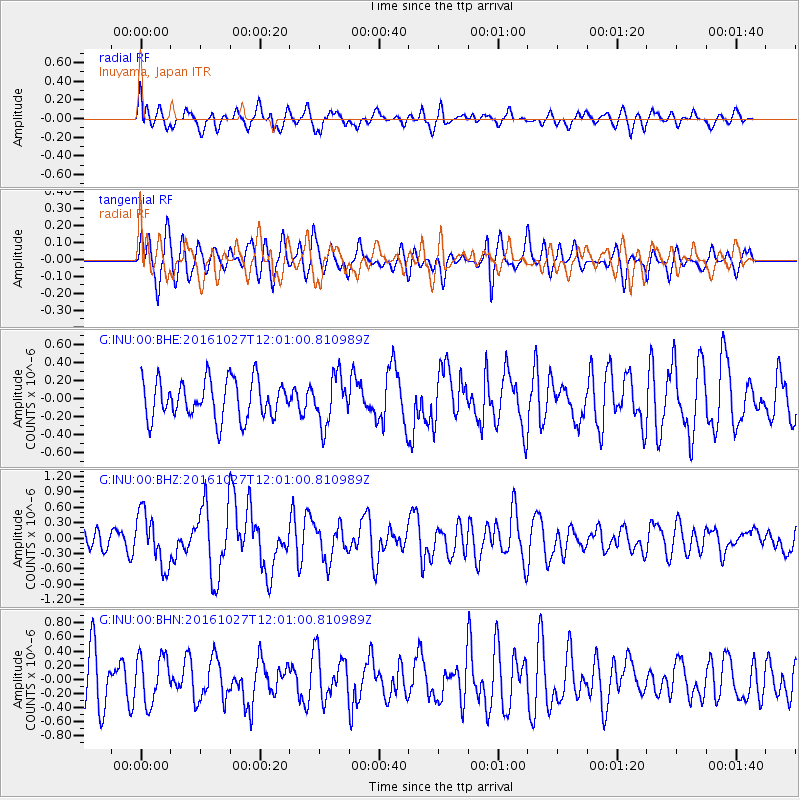
INU Inuyama, Japan - Earthquake Result Viewer
*The percent match for this event was below the threshold and hence no stack was calculated.
| Earthquake location: |
Unimak Island Region, Alaska |
| Earthquake latitude/longitude: |
53.6/-163.3 |
| Earthquake time(UTC): |
2016/10/27 (301) 11:53:18 GMT |
| Earthquake Depth: |
17 km |
| Earthquake Magnitude: |
5.8 MWP, 5.8 MI |
| Earthquake Catalog/Contributor: |
NEIC PDE/NEIC COMCAT |
|
| Network: |
G GEOSCOPE |
| Station: |
INU Inuyama, Japan |
| Lat/Lon: |
35.35 N/137.03 E |
| Elevation: |
132 m |
|
| Distance: |
44.9 deg |
| Az: |
270.955 deg |
| Baz: |
46.768 deg |
| Ray Param: |
$rayparam |
*The percent match for this event was below the threshold and hence was not used in the summary stack. |
|
| Radial Match: |
65.142204 % |
| Radial Bump: |
400 |
| Transverse Match: |
61.89394 % |
| Transverse Bump: |
400 |
| SOD ConfigId: |
1815711 |
| Insert Time: |
2016-11-10 11:54:48.172 +0000 |
| GWidth: |
2.5 |
| Max Bumps: |
400 |
| Tol: |
0.001 |
|
Signal To Noise
| Channel | StoN | STA | LTA |
| G:INU:00:BHZ:20161027T12:01:00.810989Z | 2.3523366 | 5.104066E-7 | 2.1697855E-7 |
| G:INU:00:BHN:20161027T12:01:00.810989Z | 0.9382198 | 3.3321956E-7 | 3.5516152E-7 |
| G:INU:00:BHE:20161027T12:01:00.810989Z | 1.2466031 | 2.6861804E-7 | 2.1548E-7 |
| Arrivals |
| Ps | |
| PpPs | |
| PsPs/PpSs | |


