You are here: Home > Network List > IU - Global Seismograph Network (GSN - IRIS/USGS) Stations List
> Station MAKZ Makanchi, Kazakhstan > Earthquake Result Viewer
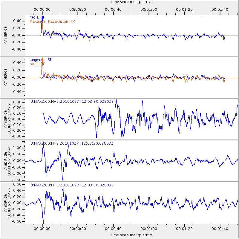
MAKZ Makanchi, Kazakhstan - Earthquake Result Viewer
*The percent match for this event was below the threshold and hence no stack was calculated.
| Earthquake location: |
Unimak Island Region, Alaska |
| Earthquake latitude/longitude: |
53.6/-163.3 |
| Earthquake time(UTC): |
2016/10/27 (301) 11:53:18 GMT |
| Earthquake Depth: |
17 km |
| Earthquake Magnitude: |
5.8 MWP, 5.8 MI |
| Earthquake Catalog/Contributor: |
NEIC PDE/NEIC COMCAT |
|
| Network: |
IU Global Seismograph Network (GSN - IRIS/USGS) |
| Station: |
MAKZ Makanchi, Kazakhstan |
| Lat/Lon: |
46.81 N/81.98 E |
| Elevation: |
600 m |
|
| Distance: |
65.6 deg |
| Az: |
316.782 deg |
| Baz: |
36.43 deg |
| Ray Param: |
$rayparam |
*The percent match for this event was below the threshold and hence was not used in the summary stack. |
|
| Radial Match: |
78.49065 % |
| Radial Bump: |
400 |
| Transverse Match: |
64.58674 % |
| Transverse Bump: |
400 |
| SOD ConfigId: |
1815711 |
| Insert Time: |
2016-11-10 11:57:55.262 +0000 |
| GWidth: |
2.5 |
| Max Bumps: |
400 |
| Tol: |
0.001 |
|
Signal To Noise
| Channel | StoN | STA | LTA |
| IU:MAKZ:00:HHZ:20161027T12:03:30.02803Z | 10.959249 | 6.822862E-7 | 6.225666E-8 |
| IU:MAKZ:00:HH1:20161027T12:03:30.02803Z | 4.057004 | 2.9581346E-7 | 7.291427E-8 |
| IU:MAKZ:00:HH2:20161027T12:03:30.02803Z | 2.3127058 | 1.2656469E-7 | 5.472581E-8 |
| Arrivals |
| Ps | |
| PpPs | |
| PsPs/PpSs | |


