You are here: Home > Network List > IU - Global Seismograph Network (GSN - IRIS/USGS) Stations List
> Station RSSD Black Hills, South Dakota, USA > Earthquake Result Viewer
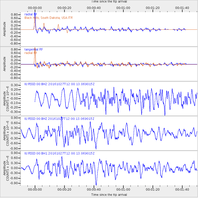
RSSD Black Hills, South Dakota, USA - Earthquake Result Viewer
*The percent match for this event was below the threshold and hence no stack was calculated.
| Earthquake location: |
Unimak Island Region, Alaska |
| Earthquake latitude/longitude: |
53.6/-163.3 |
| Earthquake time(UTC): |
2016/10/27 (301) 11:53:18 GMT |
| Earthquake Depth: |
17 km |
| Earthquake Magnitude: |
5.8 MWP, 5.8 MI |
| Earthquake Catalog/Contributor: |
NEIC PDE/NEIC COMCAT |
|
| Network: |
IU Global Seismograph Network (GSN - IRIS/USGS) |
| Station: |
RSSD Black Hills, South Dakota, USA |
| Lat/Lon: |
44.12 N/104.04 W |
| Elevation: |
2090 m |
|
| Distance: |
39.0 deg |
| Az: |
79.259 deg |
| Baz: |
305.65 deg |
| Ray Param: |
$rayparam |
*The percent match for this event was below the threshold and hence was not used in the summary stack. |
|
| Radial Match: |
79.06976 % |
| Radial Bump: |
285 |
| Transverse Match: |
54.89917 % |
| Transverse Bump: |
394 |
| SOD ConfigId: |
1815711 |
| Insert Time: |
2016-11-10 11:58:16.009 +0000 |
| GWidth: |
2.5 |
| Max Bumps: |
400 |
| Tol: |
0.001 |
|
Signal To Noise
| Channel | StoN | STA | LTA |
| IU:RSSD:00:BHZ:20161027T12:00:13.069015Z | 2.4127464 | 3.3335402E-7 | 1.3816373E-7 |
| IU:RSSD:00:BH1:20161027T12:00:13.069015Z | 2.521369 | 2.917873E-7 | 1.1572575E-7 |
| IU:RSSD:00:BH2:20161027T12:00:13.069015Z | 0.88469714 | 1.08930166E-7 | 1.2312707E-7 |
| Arrivals |
| Ps | |
| PpPs | |
| PsPs/PpSs | |


