You are here: Home > Network List > TA - USArray Transportable Network (new EarthScope stations) Stations List
> Station I17A Pilgram Creek (NPS), Teton National Park, WY, USA > Earthquake Result Viewer
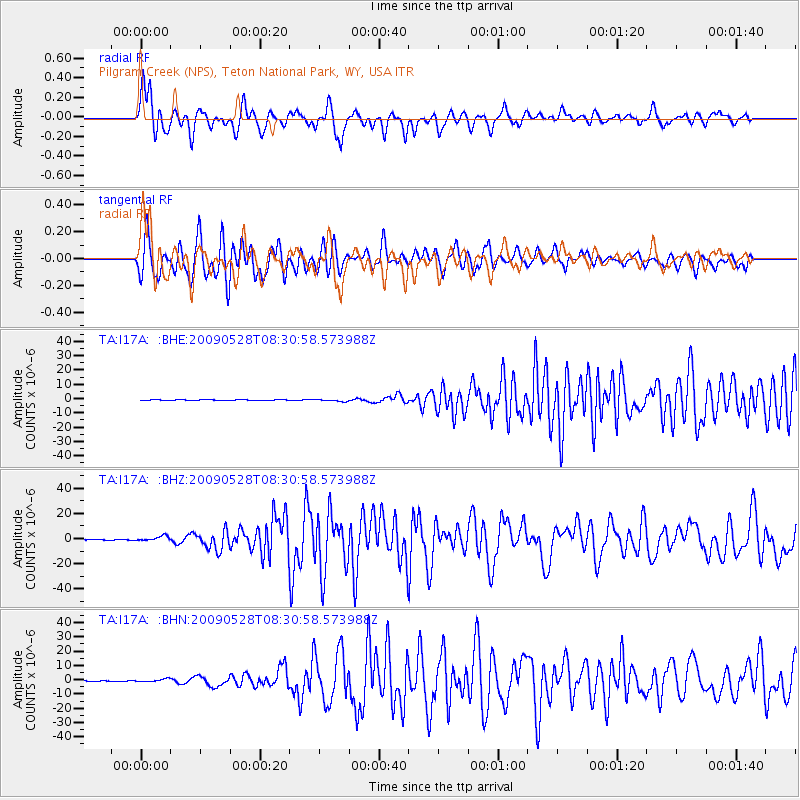
I17A Pilgram Creek (NPS), Teton National Park, WY, USA - Earthquake Result Viewer
*The percent match for this event was below the threshold and hence no stack was calculated.
| Earthquake location: |
North Of Honduras |
| Earthquake latitude/longitude: |
16.7/-86.2 |
| Earthquake time(UTC): |
2009/05/28 (148) 08:24:45 GMT |
| Earthquake Depth: |
10 km |
| Earthquake Magnitude: |
6.7 MB, 7.2 MS, 7.3 MW, 7.3 MW |
| Earthquake Catalog/Contributor: |
WHDF/NEIC |
|
| Network: |
TA USArray Transportable Network (new EarthScope stations) |
| Station: |
I17A Pilgram Creek (NPS), Teton National Park, WY, USA |
| Lat/Lon: |
43.92 N/110.58 W |
| Elevation: |
2134 m |
|
| Distance: |
34.1 deg |
| Az: |
327.861 deg |
| Baz: |
135.136 deg |
| Ray Param: |
$rayparam |
*The percent match for this event was below the threshold and hence was not used in the summary stack. |
|
| Radial Match: |
81.59277 % |
| Radial Bump: |
400 |
| Transverse Match: |
78.60656 % |
| Transverse Bump: |
400 |
| SOD ConfigId: |
2648 |
| Insert Time: |
2010-03-06 22:04:28.171 +0000 |
| GWidth: |
2.5 |
| Max Bumps: |
400 |
| Tol: |
0.001 |
|
Signal To Noise
| Channel | StoN | STA | LTA |
| TA:I17A: :BHZ:20090528T08:30:58.573988Z | 19.576714 | 2.0668551E-6 | 1.05577215E-7 |
| TA:I17A: :BHN:20090528T08:30:58.573988Z | 13.295503 | 9.905057E-7 | 7.4499305E-8 |
| TA:I17A: :BHE:20090528T08:30:58.573988Z | 3.7676177 | 7.4550417E-7 | 1.978715E-7 |
| Arrivals |
| Ps | |
| PpPs | |
| PsPs/PpSs | |


