You are here: Home > Network List > TA - USArray Transportable Network (new EarthScope stations) Stations List
> Station R33M Jennings River, BC, CAN > Earthquake Result Viewer
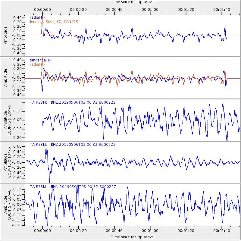
R33M Jennings River, BC, CAN - Earthquake Result Viewer
*The percent match for this event was below the threshold and hence no stack was calculated.
| Earthquake location: |
Luzon, Philippines |
| Earthquake latitude/longitude: |
18.7/120.9 |
| Earthquake time(UTC): |
2019/05/06 (126) 02:48:42 GMT |
| Earthquake Depth: |
35 km |
| Earthquake Magnitude: |
5.5 Mww |
| Earthquake Catalog/Contributor: |
NEIC PDE/us |
|
| Network: |
TA USArray Transportable Network (new EarthScope stations) |
| Station: |
R33M Jennings River, BC, CAN |
| Lat/Lon: |
59.39 N/130.97 W |
| Elevation: |
1437 m |
|
| Distance: |
82.9 deg |
| Az: |
29.335 deg |
| Baz: |
294.852 deg |
| Ray Param: |
$rayparam |
*The percent match for this event was below the threshold and hence was not used in the summary stack. |
|
| Radial Match: |
53.34819 % |
| Radial Bump: |
400 |
| Transverse Match: |
69.21432 % |
| Transverse Bump: |
400 |
| SOD ConfigId: |
18252611 |
| Insert Time: |
2019-05-20 02:53:14.504 +0000 |
| GWidth: |
2.5 |
| Max Bumps: |
400 |
| Tol: |
0.001 |
|
Signal To Noise
| Channel | StoN | STA | LTA |
| TA:R33M: :BHZ:20190506T03:00:32.800022Z | 3.5562644 | 3.279099E-7 | 9.220628E-8 |
| TA:R33M: :BHN:20190506T03:00:32.800022Z | 1.3795751 | 8.545273E-8 | 6.194134E-8 |
| TA:R33M: :BHE:20190506T03:00:32.800022Z | 1.508454 | 8.8177444E-8 | 5.845551E-8 |
| Arrivals |
| Ps | |
| PpPs | |
| PsPs/PpSs | |


