You are here: Home > Network List > TS - TERRAscope (Southern California Seismic Network) Stations List
> Station DGR Domenigoni Valley Reservior, California, USA > Earthquake Result Viewer
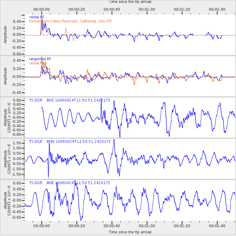
DGR Domenigoni Valley Reservior, California, USA - Earthquake Result Viewer
*The percent match for this event was below the threshold and hence no stack was calculated.
| Earthquake location: |
Leeward Islands |
| Earthquake latitude/longitude: |
15.2/-61.4 |
| Earthquake time(UTC): |
1996/09/24 (268) 11:42:18 GMT |
| Earthquake Depth: |
147 km |
| Earthquake Magnitude: |
6.0 MB, 5.9 UNKNOWN, 5.7 MW |
| Earthquake Catalog/Contributor: |
WHDF/NEIC |
|
| Network: |
TS TERRAscope (Southern California Seismic Network) |
| Station: |
DGR Domenigoni Valley Reservior, California, USA |
| Lat/Lon: |
33.65 N/117.01 W |
| Elevation: |
700 m |
|
| Distance: |
53.2 deg |
| Az: |
300.773 deg |
| Baz: |
96.014 deg |
| Ray Param: |
$rayparam |
*The percent match for this event was below the threshold and hence was not used in the summary stack. |
|
| Radial Match: |
62.922882 % |
| Radial Bump: |
400 |
| Transverse Match: |
47.467693 % |
| Transverse Bump: |
400 |
| SOD ConfigId: |
4480 |
| Insert Time: |
2010-02-26 14:11:41.019 +0000 |
| GWidth: |
2.5 |
| Max Bumps: |
400 |
| Tol: |
0.001 |
|
Signal To Noise
| Channel | StoN | STA | LTA |
| TS:DGR: :BHN:19960924T11:50:51.242017Z | 2.2510555 | 5.3210823E-7 | 2.3638167E-7 |
| TS:DGR: :BHE:19960924T11:50:51.242017Z | 1.8817939 | 3.188925E-7 | 1.6946197E-7 |
| TS:DGR: :BHZ:19960924T11:50:51.242017Z | 0.8189396 | 2.2071596E-7 | 2.6951432E-7 |
| Arrivals |
| Ps | |
| PpPs | |
| PsPs/PpSs | |


