You are here: Home > Network List > US - United States National Seismic Network Stations List
> Station DGMT Dagmar, Montana, USA > Earthquake Result Viewer
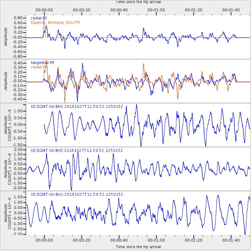
DGMT Dagmar, Montana, USA - Earthquake Result Viewer
*The percent match for this event was below the threshold and hence no stack was calculated.
| Earthquake location: |
Unimak Island Region, Alaska |
| Earthquake latitude/longitude: |
53.6/-163.3 |
| Earthquake time(UTC): |
2016/10/27 (301) 11:53:18 GMT |
| Earthquake Depth: |
17 km |
| Earthquake Magnitude: |
5.8 MWP, 5.8 MI |
| Earthquake Catalog/Contributor: |
NEIC PDE/NEIC COMCAT |
|
| Network: |
US United States National Seismic Network |
| Station: |
DGMT Dagmar, Montana, USA |
| Lat/Lon: |
48.47 N/104.20 W |
| Elevation: |
0.0 m |
|
| Distance: |
36.6 deg |
| Az: |
73.424 deg |
| Baz: |
300.922 deg |
| Ray Param: |
$rayparam |
*The percent match for this event was below the threshold and hence was not used in the summary stack. |
|
| Radial Match: |
71.927635 % |
| Radial Bump: |
400 |
| Transverse Match: |
55.374622 % |
| Transverse Bump: |
400 |
| SOD ConfigId: |
1815711 |
| Insert Time: |
2016-11-10 12:01:20.599 +0000 |
| GWidth: |
2.5 |
| Max Bumps: |
400 |
| Tol: |
0.001 |
|
Signal To Noise
| Channel | StoN | STA | LTA |
| US:DGMT:00:BHZ:20161027T11:59:52.125015Z | 3.8295007 | 9.556352E-7 | 2.4954565E-7 |
| US:DGMT:00:BH1:20161027T11:59:52.125015Z | 1.1131536 | 6.4735764E-7 | 5.8155285E-7 |
| US:DGMT:00:BH2:20161027T11:59:52.125015Z | 0.8407731 | 4.6944132E-7 | 5.583448E-7 |
| Arrivals |
| Ps | |
| PpPs | |
| PsPs/PpSs | |


