You are here: Home > Network List > UU - University of Utah Regional Network Stations List
> Station FORU South Mineral Mountains, UT, USA > Earthquake Result Viewer
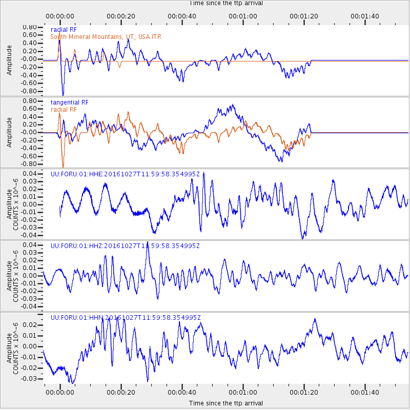
FORU South Mineral Mountains, UT, USA - Earthquake Result Viewer
*The percent match for this event was below the threshold and hence no stack was calculated.
| Earthquake location: |
Unimak Island Region, Alaska |
| Earthquake latitude/longitude: |
53.6/-163.3 |
| Earthquake time(UTC): |
2016/10/27 (301) 11:53:18 GMT |
| Earthquake Depth: |
17 km |
| Earthquake Magnitude: |
5.8 MWP, 5.8 MI |
| Earthquake Catalog/Contributor: |
NEIC PDE/NEIC COMCAT |
|
| Network: |
UU University of Utah Regional Network |
| Station: |
FORU South Mineral Mountains, UT, USA |
| Lat/Lon: |
38.46 N/112.86 W |
| Elevation: |
1840 m |
|
| Distance: |
37.3 deg |
| Az: |
93.111 deg |
| Baz: |
310.746 deg |
| Ray Param: |
$rayparam |
*The percent match for this event was below the threshold and hence was not used in the summary stack. |
|
| Radial Match: |
61.856396 % |
| Radial Bump: |
400 |
| Transverse Match: |
60.552708 % |
| Transverse Bump: |
400 |
| SOD ConfigId: |
1815711 |
| Insert Time: |
2016-11-10 12:02:41.871 +0000 |
| GWidth: |
2.5 |
| Max Bumps: |
400 |
| Tol: |
0.001 |
|
Signal To Noise
| Channel | StoN | STA | LTA |
| UU:FORU:01:HHZ:20161027T11:59:58.354995Z | 1.1061441 | 1.0065311E-8 | 9.099458E-9 |
| UU:FORU:01:HHN:20161027T11:59:58.354995Z | 1.8049695 | 3.1557846E-8 | 1.7483867E-8 |
| UU:FORU:01:HHE:20161027T11:59:58.354995Z | 2.47436 | 2.7310058E-8 | 1.1037222E-8 |
| Arrivals |
| Ps | |
| PpPs | |
| PsPs/PpSs | |


