You are here: Home > Network List > TA - USArray Transportable Network (new EarthScope stations) Stations List
> Station M10A I.L. Ranch, Tuscararo, NV, USA > Earthquake Result Viewer
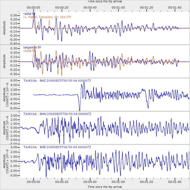
M10A I.L. Ranch, Tuscararo, NV, USA - Earthquake Result Viewer
*The percent match for this event was below the threshold and hence no stack was calculated.
| Earthquake location: |
Chile-Argentina Border Region |
| Earthquake latitude/longitude: |
-24.4/-67.0 |
| Earthquake time(UTC): |
2006/08/25 (237) 00:44:46 GMT |
| Earthquake Depth: |
184 km |
| Earthquake Magnitude: |
5.9 MB, 6.6 MW, 6.6 MW |
| Earthquake Catalog/Contributor: |
WHDF/NEIC |
|
| Network: |
TA USArray Transportable Network (new EarthScope stations) |
| Station: |
M10A I.L. Ranch, Tuscararo, NV, USA |
| Lat/Lon: |
41.52 N/116.54 W |
| Elevation: |
1687 m |
|
| Distance: |
80.0 deg |
| Az: |
324.56 deg |
| Baz: |
135.251 deg |
| Ray Param: |
$rayparam |
*The percent match for this event was below the threshold and hence was not used in the summary stack. |
|
| Radial Match: |
85.94787 % |
| Radial Bump: |
400 |
| Transverse Match: |
81.653305 % |
| Transverse Bump: |
400 |
| SOD ConfigId: |
2665 |
| Insert Time: |
2010-03-06 22:08:43.031 +0000 |
| GWidth: |
2.5 |
| Max Bumps: |
400 |
| Tol: |
0.001 |
|
Signal To Noise
| Channel | StoN | STA | LTA |
| TA:M10A: :BHN:20060825T00:56:04.000007Z | 5.184051 | 6.669892E-7 | 1.2866177E-7 |
| TA:M10A: :BHE:20060825T00:56:04.000007Z | 6.6251683 | 8.91444E-7 | 1.3455417E-7 |
| TA:M10A: :BHZ:20060825T00:56:04.000007Z | 32.441048 | 2.91479E-6 | 8.984882E-8 |
| Arrivals |
| Ps | |
| PpPs | |
| PsPs/PpSs | |


