You are here: Home > Network List > WY - Yellowstone Wyoming Seismic Network Stations List
> Station YHR Hawk's Rest, WY, USA > Earthquake Result Viewer
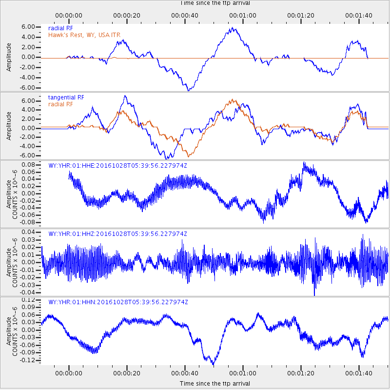
YHR Hawk's Rest, WY, USA - Earthquake Result Viewer
*The percent match for this event was below the threshold and hence no stack was calculated.
| Earthquake location: |
New Ireland Region, P.N.G. |
| Earthquake latitude/longitude: |
-4.7/153.2 |
| Earthquake time(UTC): |
2016/10/28 (302) 05:26:57 GMT |
| Earthquake Depth: |
61 km |
| Earthquake Magnitude: |
5.7 MB |
| Earthquake Catalog/Contributor: |
NEIC PDE/NEIC COMCAT |
|
| Network: |
WY Yellowstone Wyoming Seismic Network |
| Station: |
YHR Hawk's Rest, WY, USA |
| Lat/Lon: |
44.11 N/110.08 W |
| Elevation: |
2976 m |
|
| Distance: |
98.1 deg |
| Az: |
46.27 deg |
| Baz: |
271.308 deg |
| Ray Param: |
$rayparam |
*The percent match for this event was below the threshold and hence was not used in the summary stack. |
|
| Radial Match: |
63.907333 % |
| Radial Bump: |
400 |
| Transverse Match: |
48.045856 % |
| Transverse Bump: |
400 |
| SOD ConfigId: |
1815711 |
| Insert Time: |
2016-11-11 05:31:04.613 +0000 |
| GWidth: |
2.5 |
| Max Bumps: |
400 |
| Tol: |
0.001 |
|
Signal To Noise
| Channel | StoN | STA | LTA |
| WY:YHR:01:HHZ:20161028T05:39:56.227974Z | 1.5487506 | 1.4124446E-8 | 9.119896E-9 |
| WY:YHR:01:HHN:20161028T05:39:56.227974Z | 0.8230237 | 3.3011304E-8 | 4.0109786E-8 |
| WY:YHR:01:HHE:20161028T05:39:56.227974Z | 1.1487775 | 2.550469E-8 | 2.2201593E-8 |
| Arrivals |
| Ps | |
| PpPs | |
| PsPs/PpSs | |


