You are here: Home > Network List > PF - Volcanologic Network of Piton de Fournaise-OVPF Stations List
> Station HIM cratere Himiltrude > Earthquake Result Viewer
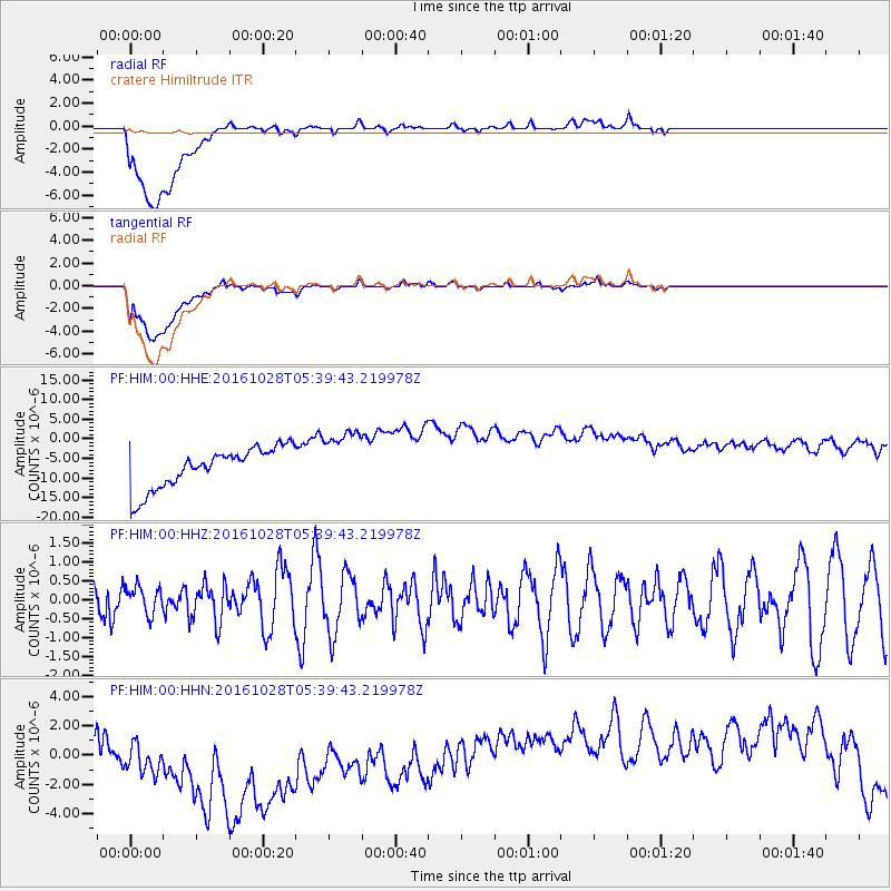
HIM cratere Himiltrude - Earthquake Result Viewer
*The percent match for this event was below the threshold and hence no stack was calculated.
| Earthquake location: |
New Ireland Region, P.N.G. |
| Earthquake latitude/longitude: |
-4.7/153.2 |
| Earthquake time(UTC): |
2016/10/28 (302) 05:26:57 GMT |
| Earthquake Depth: |
61 km |
| Earthquake Magnitude: |
5.7 MB |
| Earthquake Catalog/Contributor: |
NEIC PDE/NEIC COMCAT |
|
| Network: |
PF Volcanologic Network of Piton de Fournaise-OVPF |
| Station: |
HIM cratere Himiltrude |
| Lat/Lon: |
21.21 S/55.72 E |
| Elevation: |
1958 m |
|
| Distance: |
95.2 deg |
| Az: |
248.291 deg |
| Baz: |
97.07 deg |
| Ray Param: |
$rayparam |
*The percent match for this event was below the threshold and hence was not used in the summary stack. |
|
| Radial Match: |
21.973078 % |
| Radial Bump: |
400 |
| Transverse Match: |
20.537828 % |
| Transverse Bump: |
400 |
| SOD ConfigId: |
1815711 |
| Insert Time: |
2016-11-11 05:31:33.969 +0000 |
| GWidth: |
2.5 |
| Max Bumps: |
400 |
| Tol: |
0.001 |
|
Signal To Noise
| Channel | StoN | STA | LTA |
| PF:HIM:00:HHZ:20161028T05:39:43.219978Z | 0.6519302 | 3.6677676E-7 | 5.6260126E-7 |
| PF:HIM:00:HHN:20161028T05:39:43.219978Z | 1.3876332 | 6.7472633E-6 | 4.8624256E-6 |
| PF:HIM:00:HHE:20161028T05:39:43.219978Z | 1.4851133 | 7.662797E-6 | 5.159739E-6 |
| Arrivals |
| Ps | |
| PpPs | |
| PsPs/PpSs | |


