You are here: Home > Network List > TA - USArray Transportable Network (new EarthScope stations) Stations List
> Station B14A Marquette Ranch, East Glacier, MT, USA > Earthquake Result Viewer
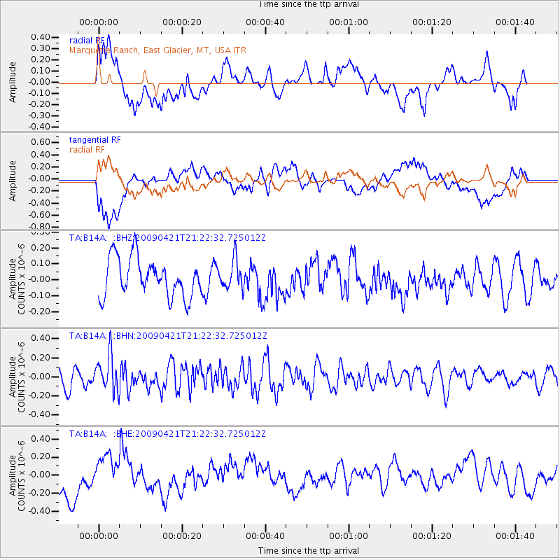
B14A Marquette Ranch, East Glacier, MT, USA - Earthquake Result Viewer
*The percent match for this event was below the threshold and hence no stack was calculated.
| Earthquake location: |
Santa Cruz Islands |
| Earthquake latitude/longitude: |
-10.8/166.0 |
| Earthquake time(UTC): |
2009/04/21 (111) 21:09:59 GMT |
| Earthquake Depth: |
35 km |
| Earthquake Magnitude: |
5.7 MW, 5.0 MS, 5.3 MB, 5.7 MW |
| Earthquake Catalog/Contributor: |
WHDF/NEIC |
|
| Network: |
TA USArray Transportable Network (new EarthScope stations) |
| Station: |
B14A Marquette Ranch, East Glacier, MT, USA |
| Lat/Lon: |
48.36 N/113.27 W |
| Elevation: |
1529 m |
|
| Distance: |
91.9 deg |
| Az: |
41.186 deg |
| Baz: |
255.962 deg |
| Ray Param: |
$rayparam |
*The percent match for this event was below the threshold and hence was not used in the summary stack. |
|
| Radial Match: |
50.789436 % |
| Radial Bump: |
400 |
| Transverse Match: |
53.604458 % |
| Transverse Bump: |
400 |
| SOD ConfigId: |
2658 |
| Insert Time: |
2010-03-06 22:11:11.978 +0000 |
| GWidth: |
2.5 |
| Max Bumps: |
400 |
| Tol: |
0.001 |
|
Signal To Noise
| Channel | StoN | STA | LTA |
| TA:B14A: :BHN:20090421T21:22:32.725012Z | 2.2775114 | 1.9244536E-7 | 8.449809E-8 |
| TA:B14A: :BHE:20090421T21:22:32.725012Z | 0.76824045 | 1.9473939E-7 | 2.5348754E-7 |
| TA:B14A: :BHZ:20090421T21:22:32.725012Z | 0.7700086 | 9.284898E-8 | 1.2058173E-7 |
| Arrivals |
| Ps | |
| PpPs | |
| PsPs/PpSs | |


