You are here: Home > Network List > GS - US Geological Survey Networks Stations List
> Station KAN08 Pence Farm, Harper, KS, USA > Earthquake Result Viewer
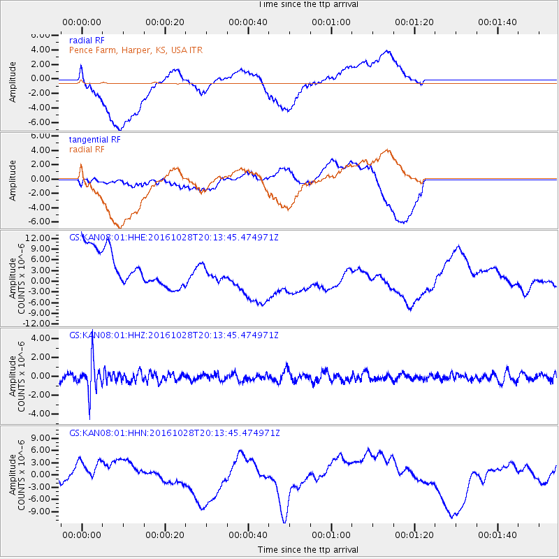
KAN08 Pence Farm, Harper, KS, USA - Earthquake Result Viewer
*The percent match for this event was below the threshold and hence no stack was calculated.
| Earthquake location: |
Tyrrhenian Sea |
| Earthquake latitude/longitude: |
39.3/13.5 |
| Earthquake time(UTC): |
2016/10/28 (302) 20:02:48 GMT |
| Earthquake Depth: |
448 km |
| Earthquake Magnitude: |
5.8 MWW, 5.8 MWB |
| Earthquake Catalog/Contributor: |
NEIC PDE/NEIC COMCAT |
|
| Network: |
GS US Geological Survey Networks |
| Station: |
KAN08 Pence Farm, Harper, KS, USA |
| Lat/Lon: |
37.23 N/97.97 W |
| Elevation: |
375 m |
|
| Distance: |
81.2 deg |
| Az: |
311.281 deg |
| Baz: |
46.917 deg |
| Ray Param: |
$rayparam |
*The percent match for this event was below the threshold and hence was not used in the summary stack. |
|
| Radial Match: |
43.597828 % |
| Radial Bump: |
400 |
| Transverse Match: |
40.963284 % |
| Transverse Bump: |
400 |
| SOD ConfigId: |
1815711 |
| Insert Time: |
2016-11-11 20:06:21.036 +0000 |
| GWidth: |
2.5 |
| Max Bumps: |
400 |
| Tol: |
0.001 |
|
Signal To Noise
| Channel | StoN | STA | LTA |
| GS:KAN08:01:HHZ:20161028T20:13:45.474971Z | 4.0760207 | 1.6259022E-6 | 3.9889449E-7 |
| GS:KAN08:01:HHN:20161028T20:13:45.474971Z | 0.8417 | 2.2218735E-6 | 2.6397452E-6 |
| GS:KAN08:01:HHE:20161028T20:13:45.474971Z | 0.43851012 | 2.1583685E-6 | 4.9220494E-6 |
| Arrivals |
| Ps | |
| PpPs | |
| PsPs/PpSs | |


